Storm surge display helps Cape Fear residents visualize hurricane danger
WRIGHTSVILLE BEACH, N.C. — As the Cape Fear approaches the 30th anniversary of Hurricane Fran, a new storm surge pole is helping residents visualize just how high water can rise during a hurricane.
Fran made landfall in the Cape Fear region on Sept. 5, 1996, as a Category 3 hurricane, bringing damaging winds, storm surge and heavy rain to southeastern North Carolina.
The storm knocked down trees and power lines, damaged homes and left many communities without electricity.
“It was devastating. I think in some parts we were looking at heights of 11 to 12 feet along the immediate coast,” said Brandon Lockley, a warning coordination meteorologist with the National Weather Service.
Storm surge occurs when strong winds from a hurricane push ocean water toward the coast. Forecasters say it can be difficult for people to understand just how high that water can rise and how dangerous it can become.
The National Weather Service is using a new storm surge pole to help put those potential water levels into perspective.
“Working along with some other national weather service offices we created a storm surge pole because we think it does an outstanding job of getting people’s attention,” Lockley said.
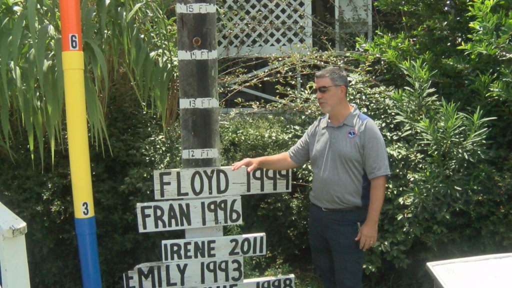
The pole uses blue, yellow, orange and red markers to illustrate increasing storm surge levels, reaching more than 9 feet.
“The way we forecast storm surge nowadays compared to 1996 is were actually trying to tell people what the water levels could be and how high the ocean water could get above ground level so folks can more easily understand and comprehend how much water that really is,” Lockley said.
Meteorologist Bob Bright said storm surge forecasting has advanced significantly since Fran struck the region.
At the Wrightsville Beach Museum, another display helps visitors compare storm surge and water levels from hurricanes that have affected the Cape Fear, including Bertha, Bonnie, Emily, Irene, Fran and Floyd.
“Where we are standing, Hurricane Fran water levels were about 3 feet above ground level. The other measurements on here are a reference to mean sea level,” Bright said.
The displays serve as a reminder that while hurricane winds often receive much of the attention, storm surge can pose a significant threat to coastal communities.