WEATHER DISCUSSION AND FORECAST
7/10/2026
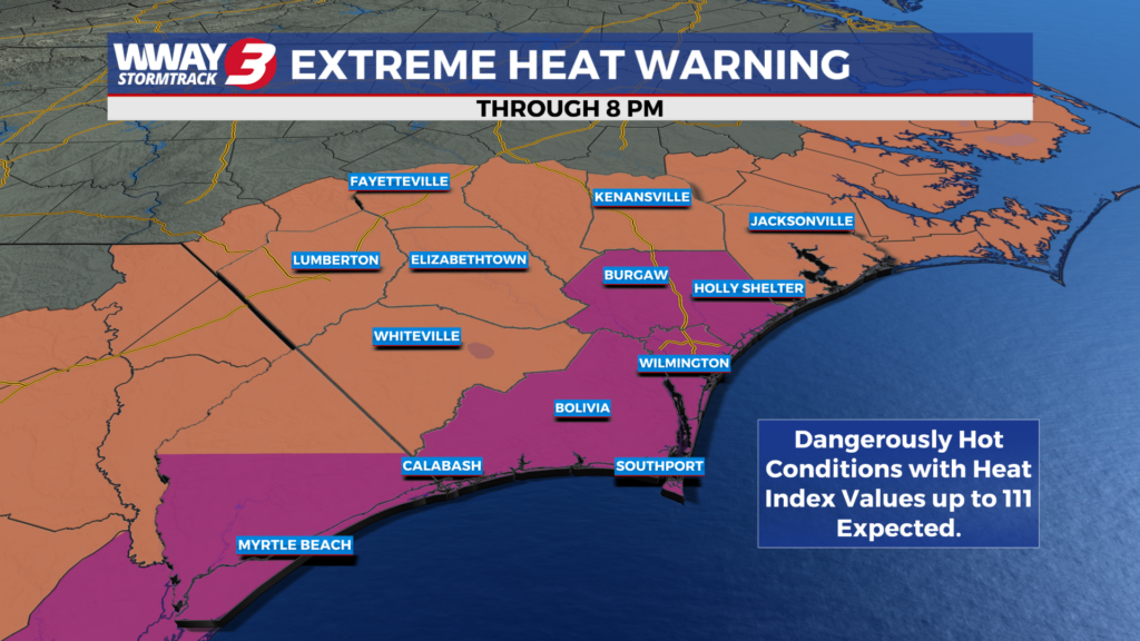
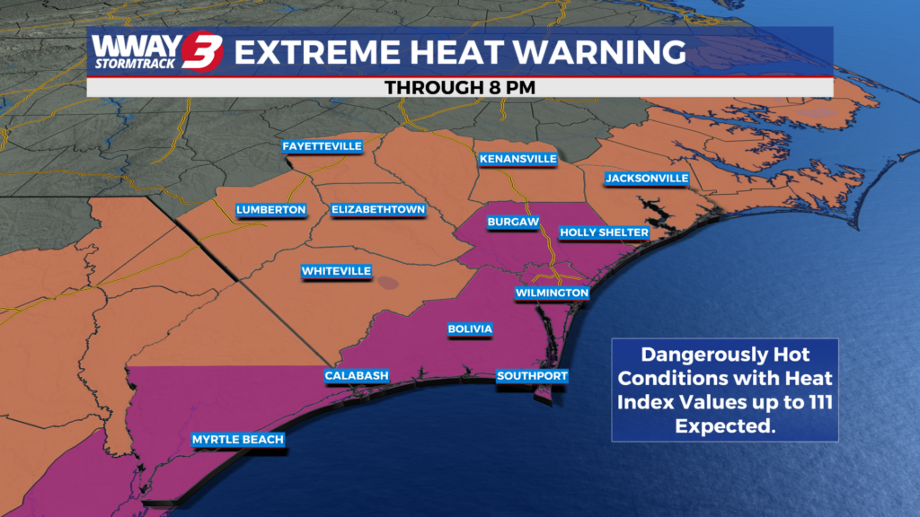
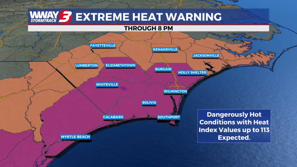
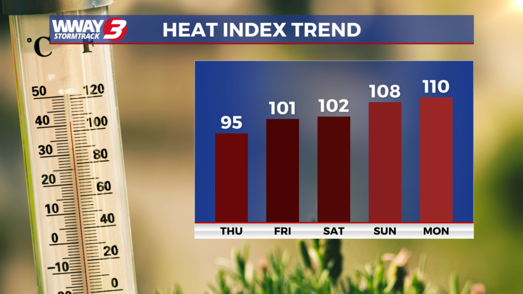
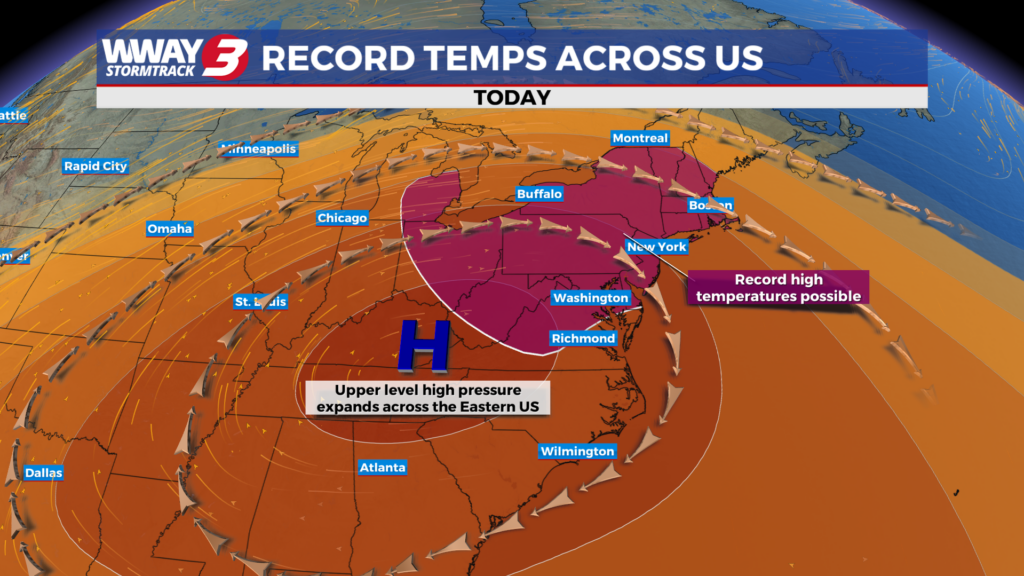
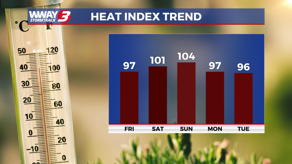
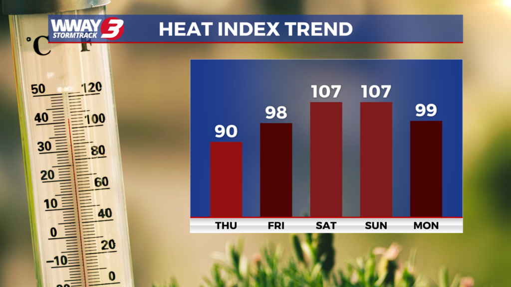
WEATHER DISCUSSION: For just the 4th time since records began in Wilmington in 1874… we have hit 100+ air temps for 3 consecutive days. It is another excessively hot and humid Friday afternoon in the Cape Fear with temps from the upper 90s to around 100 inland and lower 90s along the coast. Heat indices are running from 102-108. Isolated showers and thunderstorms have started moving across inland areas and may continue into this evening before tapering off. Look for scattered cloudiness tonight with very warm and muggy lows around 80. Hot high pressure aloft remains in control into the beginning of the weekend. We anticipate heat indices Saturday to reach as high as 102-106. The weekend brings continued very hot weather Saturday with highs in the upper 90s followed by a cold front arriving Sunday and lowering our highs to seasonable around or a little over 90. Also… there will be an increase in coverage of showers and thunderstorms this weekend… especially Sunday. The front will shift south of the area and eventually wash out by early and middle portions of next week helping take a bite out of the high heat and bringing seasonable highs in the upper 80s to around 90. Widely scattered showers and thunderstorms Monday will diminish to just a few showers or thunderstorms Tuesday with rain free weather next Wednesday and Thursday. Highs will start to heat back up by late next week reaching the lower to mid 90s.
WWAY FORECAST:
Tonight: A few showers and thunderstorms this evening. Otherwise scattered cloudiness… very warm and muggy. Low around 80. Winds southwest around 10 mph.
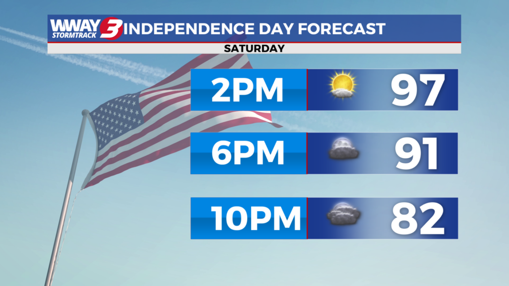
Saturday: Continued very hot and humid. Sunshine and clouds with widely scattered afternoon showers and thunderstorms developing. High in the upper 90s. Heat index values in the afternoon as high as 102-106. Winds west at 15-20 mph.
Saturday Night: Scattered showers and thunderstorms early. Variable cloudiness. Warm and muggy low in the mid to upper 70s.
Sunday: Mostly cloudy with a good chance of showers and thunderstorms. Not as hot with a seasonable high around or a little over 90. Heat index values in the afternoon reaching the lower to mid 90s.
-Chief Meteorologist Lee Haywood
To view the full 7-day forecast, click HERE.
You can follow the StormTrack 3 weather team on social media!
Chief Meteorologist Lee Haywood: FACEBOOK – X (TWITTER)
Meteorologist Jason Korver: FACEBOOK – X (TWITTER)
Meteorologist Charles McKeller: FACEBOOK–X (TWITTER)
Meteorologist Cicily Hammers: FACEBOOK – X (TIWTTER)
Keep track of the very latest StormTrack 3 forecasts and anytime severe weather threatens the area on Facebook and Twitter, and on-air by streaming us live!
Weather Maps

Local Temperatures

Current Winds

Regional Temps

Feels Like Temps

Local Radar

Carolinas Satellite/Radar

Southeast Satellite/Radar

Beach Forecast