Rainy week ahead
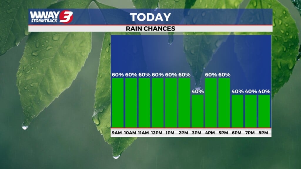
(WWAY) — Today is the start of a rainy trend for the first part of the week.
WEATHER DISCUSSION: A moist tropical air mass will remain in place through much of the week, keeping afternoon temperatures mainly in the middle to upper 80s, with warm and humid overnight lows in the mid-70s. The primary weather concern will be scattered to numerous showers and thunderstorms each day through at least midweek. While there will be breaks in the rainfall, storms will be capable of producing torrential downpours, frequent lightning, and gusty winds due to abundant tropical moisture. Localized street flooding and ponding of water on roads will be possible where heavier storms repeatedly move over the same locations. Today, the greatest coverage of showers and storms will begin near the coast and offshore this morning before shifting farther inland during the afternoon as daytime heating develops. Rain chances remain elevated through Wednesday, with a gradual drying trend expected late in the week, although isolated to scattered afternoon thunderstorms will still be possible. In addition, a high risk of rip currents exists at area beaches today, along with a strong south-to-north longshore current at all beaches except Brunswick County.
WWAY FORECAST:
Monday: Partly cloudy skies with scattered showers and storms throughout the day. High in the middle to upper 80s.
Monday Night: Continued rain and storm chances. Low in the middle 70s.
Tuesday: Showers likely with a few storms. High in the middle to upper 80s.
-Meteorologist Cicily Hammers