Cooler temperatures for Tuesday
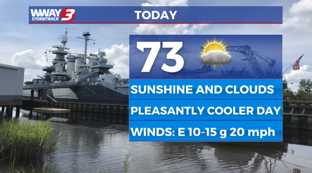
(WWAY) — Temperatures return into the lower 70s today after a cold front moved through yesterday.
High pressure builds across the region today and Wednesday bringing a return to dry weather. Look for sunshine and clouds today with a pleasantly cooler high in the lower to mid 70s. Wednesday will bring mostly sunny skies ahead of the next cold front with highs in the upper 70s. Another cold front arrives Wednesday bringing with it more showers and thunderstorms… especially late at night. Any isolated showers or thunderstorms taper off early Thursday morning as the front moves offshore. Behind it… dry weather returns with partly cloudy skies Thursday and highs in the upper 70s to near 80. High pressure builds in and controls our weather Friday through Sunday bringing mostly sunny skies with a warming trend. Look for highs reaching the upper 70s Friday… reaching the middle 80s Saturday and heating into the upper 80s Sunday.
WWAY FORECAST:
Tuesday: Sunshine and clouds mixed. A pleasantly cooler high in the lower to mid 70s. Winds northeast becoming east at 10-15 mph.
Tuesday Night: Clear and comfortably cool. Low in the middle 50s.
Wednesday: Mostly sunny skies. A beautiful day with a high in the upper 70s.
-Meteorologist Jason Korver