Warm and less humid weather for today
(WWAY) — After a cold front moved through yesterday, temperatures and dewpoints are lower this afternoon.
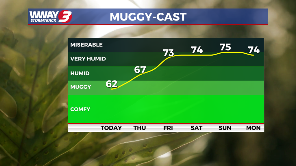
Today will be warm with low humidity as highs reach the upper 80s to near 90. Thursday looks to be rain free as well with sunshine and scattered clouds and highs around or a little over 90. Subtropical high pressure strengthens Friday with hot and humid weather returning as highs reach the lower 90s along with a slight chance of an afternoon shower or thunderstorm. This weekend will bring high heat and humidity with a few mainly afternoon and evening showers and thunderstorms. Look for sunshine and clouds with highs both Saturday and Sunday in the middle to perhaps upper 90s and heat indices above 105 likely leading to heat advisories for the region. Not much change next Monday with partly cloudy skies and isolated afternoon/evening showers or thunderstorms and highs in the lower 90s.
WWAY FORECAST:
Today: Mostly sunny skies. Warm with low humidity and a high in the upper 80s to near 90. Winds north becoming southeast at 5-10 mph.
Tonight: Fair skies. Mild low around or a little over 70.
Thursday: Sunshine and scattered clouds. Warm high around 90.
Friday: Hot and humid with temperatures into the lower 90s. isolated shower chances.
-Meteorologist Jason Korver