Hot and humid weather returns this afternoon
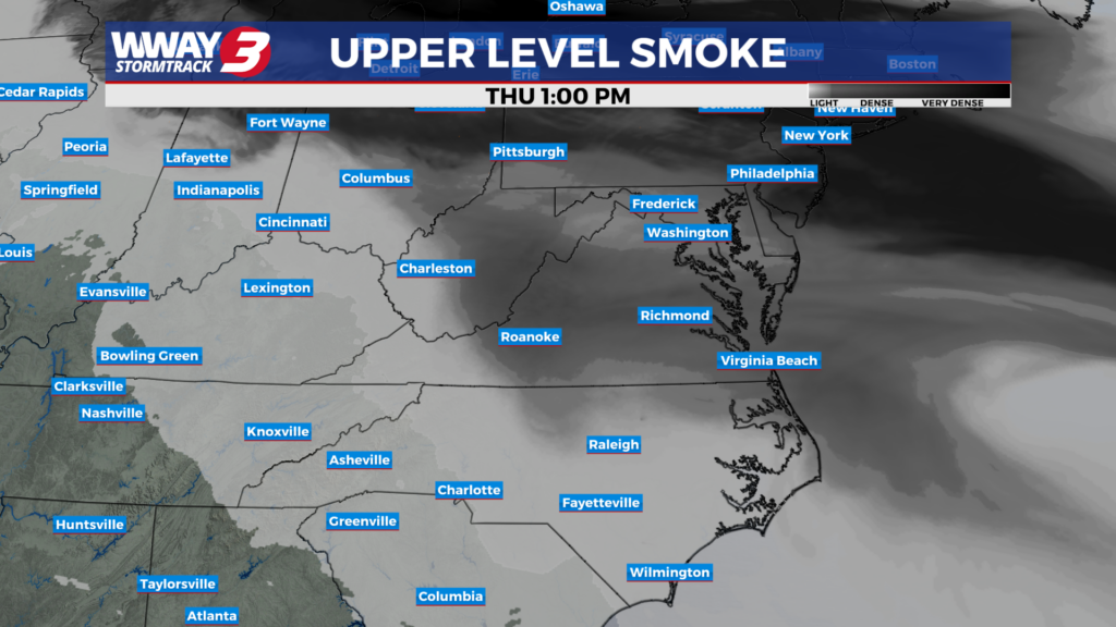
(WWAY) — Wildfire haze returns today as temperatures rise into the middle 90s.
Mostly sunny skies are expected Thursday with hot and humid highs in the mid to upper 90s. Wildfire haze could be possible throughout the day as well but it shouldn’t affect air quality. Rain free skies are expected to continue into Friday with very hot and humid highs in the upper 90s and heat indices reaching as high as 104-108. The combination of a trough across the Carolinas this weekend with increasing moisture will lead to a little better chance of unsettled weather… mainly Sunday. Look for sunshine and a few clouds Saturday with hot and humid highs in the middle 90s. Sunday will bring a few showers or thunderstorms back into your forecast with highs staying hot and humid in the middle 90s. Early next week will bring classic summer heat and humidity with hit or miss showers and thunderstorms each day as highs heat up into the lower to mid 90s. Tropical moisture from the gulf has a chance to bring increasing rain showers next week but uncertainty is high at this time.
WWAY FORECAST:
Today: Mostly sunny… hot and humid. High in the mid to upper 90s. Heat index values in the afternoon reaching from 100-104. Winds southwest becoming south at 5-10 mph.
Tonight: A few clouds. Warm and muggy low in the upper 70s.
Friday: Abundant sunshine. Continued hot and humid with a high in the upper 90s. Heat index values in the afternoon from 104-108.
Saturday: Partly sunny skies with temperatures into the middle 90s.
-Meteorologist Jason Korver