Rain chances towards the end of the week
(WWAY) — Hot and humid weather continues today as rain chances increase towards the end of the week.
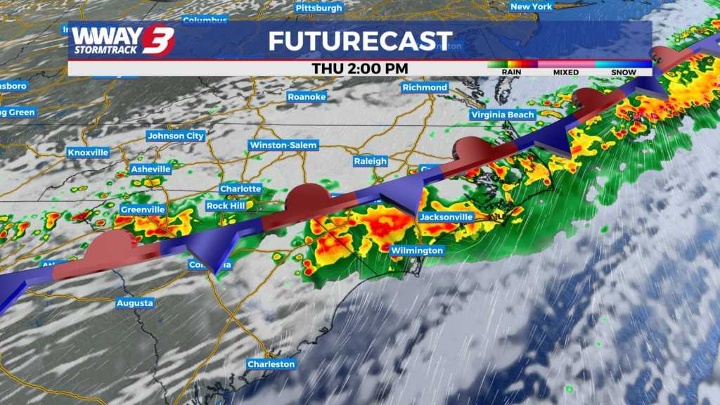
Today, subtropical high pressure dominates across the eastern Carolinas while a cold front approaches the Appalachians. It will be one more hot and humid day with partly sunny skies and hit or miss showers and thunderstorms as highs reach the mid 90s. The cold front moves toward the coast and stalls for late week bringing occasional showers and thunderstorms… some with locally heavy rainfall. Highs will drop back into the upper 80s. Rainfall amounts late this week could range from 2-4 inches which could lead to localized flash flooding between Thursday and Saturday night. Also… any thunderstorms this week have the potential to be strong with gusty winds the main severe threat. The front will likely weaken but continue stationary this weekend bringing additional chances of showers and thunderstorm Highs should remain in the upper 80s. For the beginning of next week… it will turn hot again as rain chances drop off and highs return into the lower 90s.
WWAY FORECAST:
Today: Partly sunny with hit or miss showers and thunderstorms. Hot and humid again with a high in the middle 90s. Heat index values in the afternoon ranging from 101-105. Breezy winds southwest becoming south at 15-20 mph with occasional gusts to 30 mph.
Tonight: Variable cloudiness with a chance of showers or thunderstorms… especially late. Warm and muggy low in the upper 70s.
Thursday: Mostly cloudy with showers likely and a chance of thunderstorms. Not as hot with a high in the upper 80s to near 90.
Friday: Mostly cloudy with showers likely. Temperatures into the upper 80s.
-Meteorologist Jason Korver