A heat advisory issued for today
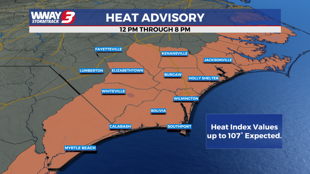
(WWAY) — Hot and humid weather returns for today.
Strong high pressure surface and aloft dominates today through Thursday bringing lower rain odds and hotter temps. Look for Mostly sunny skies today and Wednesday as highs soar into the mid to upper 90s. Heat indices will reach as high as 107-108 in spots both days with a slight chance of an afternoon or early evening shower or thunderstorm. Thursday looks to bring dry… hot and humid weather with highs in the upper 90s as the high pressure peaks across the Carolinas. Changes arrive Friday and Saturday as a cold front drops down from the north and moves through the region by the beginning of the weekend. Look for a better chance of showers and thunderstorms Friday with again a hot and humid high in the upper 90s. By Saturday… highs drop back into the lower 90s with a continued chance of showers or thunderstorms. Sunday the front sinks south of our area lowering rain chances to just isolated showers or thunderstorms with relatively seasonable highs around or a little over 90.
WWAY FORECAST:
***A HEAT ADVISORY is in effect for New Hanover, Brunswick, Pender, Columbus, and Bladen counties in the Cape Fear Tuesday from noon to 8pm. Hot temperatures combined with high humidity could lead to heat illnesses. Drink plenty of fluids… stay in an air-conditioned room… stay out of the sun and check up on relatives and neighbors. Make sure pets have adequate shade and plenty of water.***
Today: Mostly sunny… hot and humid. A slight chance of a late day shower or thunderstorm. High in the upper 90s. Heat index values reaching as high as 105-109 in the afternoon. Winds southwest around 10 mph.
Tonight: An isolated shower or thunderstorm early. Mostly clear… warm and muggy. Low in the upper 70s.
Wednesday: Plenty of sunshine mixed with a few clouds. Continued hot and humid with a high in the mid to upper 90s. Heat index values reaching as high as 104-108 in the afternoon.
Thursday: Hot and humid with lots of sunshine. Temperatures into the middle to upper 90s.
-Meteorologist Jason Korver