Another hot and humid day today
(WWAY) — Increasing rain chances today as temperatures soar into the lower 90s this afternoon.
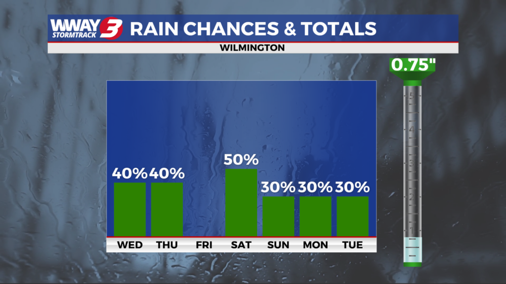
Our rather hot and humid air mass will remain in place through Thursday… supporting daily chances showers and thunderstorms. Today brings partly sunny skies with a chance of mainly afternoon showers and thunderstorms developing and a high in the upper 80s to near 90. A stronger cold front will approach late Thursday and pass through the region Thursday evening. Ahead of the front… highs reach around 90 with widely scattered showers and thunderstorms. Drier and somewhat cooler air flows in Friday behind the front with partly cloudy skies and highs in the lower 80s. The front moves back north Saturday and it will combine with a disturbance to bring scattered showers and thunderstorms and cooler highs in the upper 70s to near 80. Another cold front slips by late Saturday but our weather will continue somewhat unsettled still Sunday into early next week as a frontal boundary and deeper moisture linger to the south while high pressure sits to the north. Look for a 30% coverage of showers Sunday into early next week. Otherwise highs will be comfortable and cooler than normal reaching the upper 70s.
WWAY FORECAST:
Today: Partly sunny… rather hot and humid with a chance of mainly afternoon showers or thunderstorms. High in the upper 80s. Heat index values reaching the mid to upper 90s in the afternoon. Winds southwest around 15 mph.
Tonight: Variable cloudiness with hit or miss showers or thunderstorms possible. Warm and muggy low in the lower 70s.
Thursday: Becoming mostly cloudy with widely scattered showers and thunderstorms developing. Rather hot and humid high around 90. Heat index values reaching the mid 90s in the afternoon.
Friday: Partly to mostly sunny skies with temperatures into the lower 80s.
-Meteorologist Jason Korver