Cooler weather returns today
(WWAY) — After a cold front that moved through yesterday, temperatures fall into the lower 70s today.
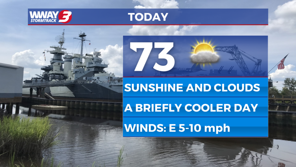
Weak high pressure moves across the Carolinas today bringing briefly cool highs and drier air. Look for sunshine and scattered clouds with highs in the lower 70s. Saturday will bring widely scattered showers and a chance of mainly afternoon thunderstorms and seasonable highs around 80. A continued somewhat unsettled pattern for Mother’s Day Sunday with a few showers possible and a small thunderstorm risk with a warmer high in the lower 80s. Despite the rain chances this weekend… there should be plenty of dry time mixed with any rain chances. Another cold front swings through the region Monday bringing scattered showers and a chance of thunderstorms with highs again in the lower 80s. Behind this cold front… high pressure builds across the region next Tuesday and Wednesday bringing a return to dry weather with increasing sunshine and highs reaching the mid 70s Tuesday to the seasonable upper 70s to around 80 next Wednesday. Enough increase in low level moisture next Thursday could bring back a slight chance of showers or a thunderstorm with highs around 80.
WWAY FORECAST:
Today: Sunshine and scattered clouds. Dry and a little cooler with a below average high in the lower 70s. Winds north becoming southeast around 10 mph.
Tonight: Mostly cloudy skies. Comfortably cool low in the upper 50s.
Saturday: Mostly cloudy with widely scattered showers and a chance of mainly afternoon thunderstorms. Seasonable high around 80.
Sunday: Mostly cloudy skies with isolated showers. Temperatures into the lower 80s.