Hot and humid once again for today
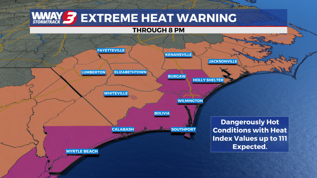
(WWAY) — Temperatures could top out in the triple digits once again this afternoon, but rain chances this weekend could cool us off.
Very hot high pressure aloft remains in control Friday and into the beginning of the weekend. We anticipate heat indices each afternoon through Saturday to reach as high as 103-111 for Friday and a little lower for Saturday. Friday… very hot and humid weather again as highs soar into the upper 90s to near 100. A few showers or thunderstorms may develop in the afternoon and evening… especially inland. The weekend brings continued very hot weather Saturday with highs in the upper 90s followed by a cold front arriving Sunday and lowering our highs to seasonable around or a little over 90. Also… there will be an increase in coverage of showers and thunderstorms this weekend… especially Sunday. The front will shift south of the area and eventually wash out by early and middle portions of next week helping take a bite out of the high heat and bringing seasonable highs in the upper 80s to around 90. Widely scattered showers and thunderstorms Monday will diminish to just a few showers or thunderstorms Tuesday and only isolated showers or thunderstorms next Wednesday.
WWAY FORECAST:
***A EXTREME HEAT WARNING is in effect for Brunswick… New Hanover and Pender counties today from 11 am to 8 pm. Very hot heat index values could reach as high as 111. Hot temperatures and high humidity may lead to heat illnesses if proper precautions are not taken. Drink plenty of fluids… stay in an air-conditioned location… stay out of the sun and check up on relatives and neighbors. Make sure pets are taken care of and have shade and plenty of water.***
Today: Excessive heat and humidity. Sunshine and a few clouds with a slight chance of afternoon showers or thunderstorms. High in the upper 90s to near 100. Heat index values in the afternoon as high as 105-111. Breezy winds west becoming southwest at 10-20 mph with occasional gusts to 25 mph.
Tonight: A few showers or thunderstorms possible in the evening… especially inland of the coast. Otherwise scattered cloudiness… very warm and muggy. Low around 80.
Saturday: Continued very hot and humid. Increasing cloudiness with scattered afternoon showers and thunderstorms. High in the upper 90s. Heat index values in the afternoon as high as 103-107.
Sunday: Mostly cloudy skies with numerous showers and thunderstorms. Temperatures into the upper 80s to lower 90s.
-Meteorologist Jason Korver