Increasing temperatures throughout the week
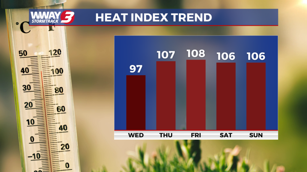
(WWAY) — Temperatures return into the upper 90s back for the end of the week.
Today and Thursday a front to the south will move back north and dissipate with our local weather turning quiet as the temps heat up. Look for plenty of sunshine today with seasonable highs in the lower 90s. Mostly sunny skies are expected Thursday with hot and humid highs in the mid to upper 90s. Rain free skies are expected to continue into Friday with very hot and humid highs in the upper 90s. The combination of a trough across the Carolinas this coming weekend with increasing moisture will lead to a little better chance of unsettled weather… mainly Sunday. Look for sunshine and clouds Saturday with hot and humid highs in the middle 90s. Sunday will bring a few showers or thunderstorms back into your forecast with highs staying hot and humid in the middle 90s. By next Monday a cold front starts to approach from the north keeping a chance of showers and thunderstorms in place with highs in the lower 90s.
WWAY FORECAST:
Today: Mostly sunny… hot and humid. High in the lower 90s. Heat index values in the afternoon reaching near 100 degrees.
Thursday: Mostly sunny skies with hot and humid weather. Temperatures into the middle 90s. Heat index values in the afternoon reaching from 100-105.
Friday: Mostly sunny skies with temperatures into the middle to upper 90s. Heat index values in the afternoon reaching from 105-108.
-Meteorologist Jason Korver