Sunshine and dry weather returns
(WWAY) — Dry weather returns to the Cape Fear.
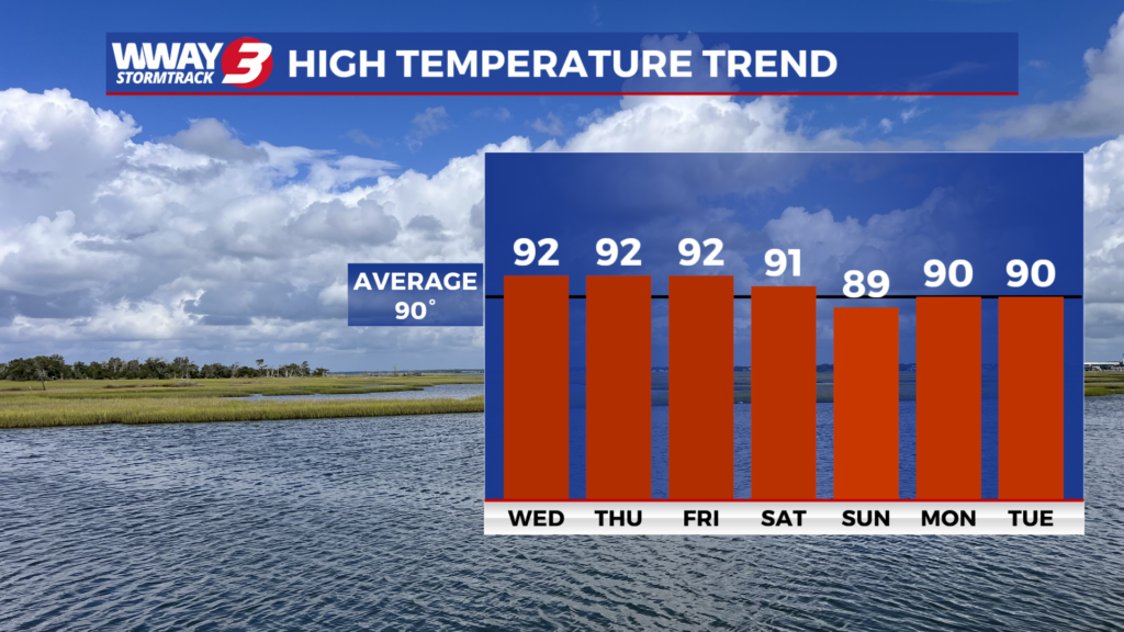
Behind a cold front that moved through earlier this morning, today, humidity will lower a little and dry weather builds in with plentiful sunshine and a few clouds with highs again in the lower to mid 90s. Late this week… high pressure and seasonably lower humidity means quiet weather with a good deal of sunshine and a few clouds and highs in the lower 90s. By this coming weekend… a front that was stalled to our south moves back north increasing humidity and moisture levels and bringing a chance of showers and thunderstorms… mainly Sunday. Otherwise near seasonable temps are expected from 90-91 with sunshine and scattered clouds each day. Next Monday the front remains stalled over the region bringing widely scattered showers and thunderstorms and highs around 90.
WWAY FORECAST:
Today: Plenty of sunshine and a few clouds. Not quite as humid. Hot high in the lower to mid 90s. Afternoon heat index values reaching the upper 90s. Wind northwest becoming west around 10 mph.
Tonight: Mostly clear skies. Mild with a low in the lower 70s.
Thursday: Mostly sunny with noticeably lower humidity. Still rather hot with a high in the lower 90s.
Friday: Partly to mostly sunny skies with temperatures into the upper 80s to lower 90s.
-Meteorologist Jason Korver