Hot and humid weather continues for Monday
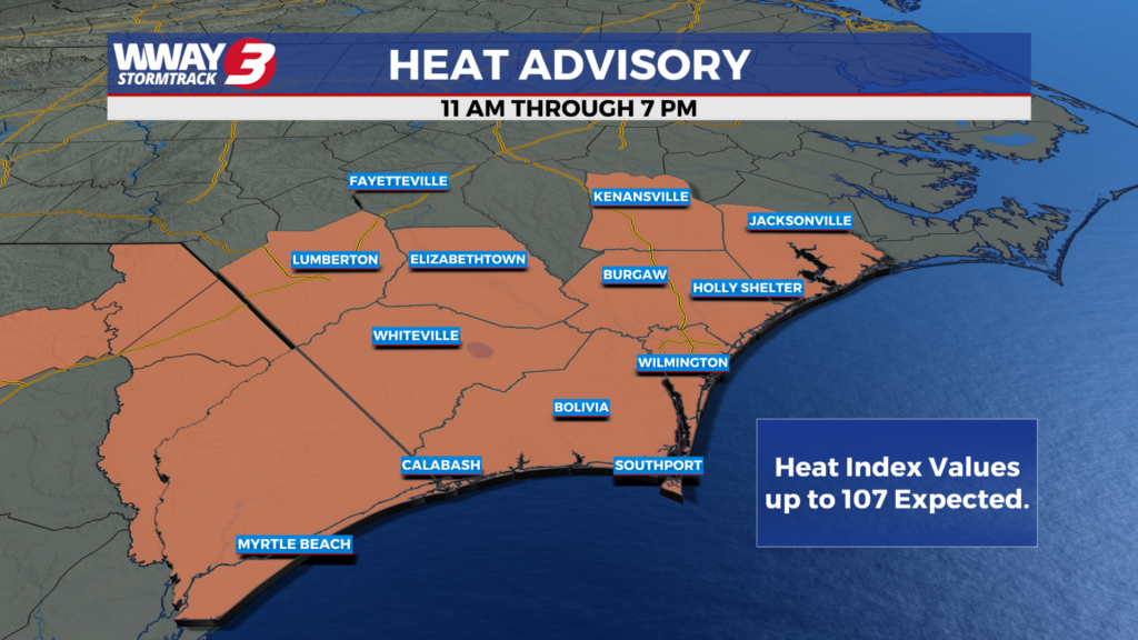
(WWAY) — Hot and humid weather continues into Monday.
After a hot and humid weekend in the Cape Fear, similar conditions are expected for the early part of this week. Today expect partly sunny skies with temperatures into the middle 90s. isolated showers is possible for today, mainly in our northern counties. For Tuesday and Wednesday, similar weather is expected as temperatures stay in the middle 90s with not as much rain chances. As we get later into the week, our rain chances sharply increase as a cold front moves in. Thursday could see numerous showers and isolated thunderstorms as the cold front pushes through the area. The front could later stall near our coastline, keeping rain chances higher to end off the work week. The Weather Prediction Center forecasts that the Cape Fear could see 4 to 7 inches of rain. The rainfall totals will be dependent on where the front stalls out.
WWAY FORECAST:
Today: Partly cloudy skies as temperatures will rise into the middle 90s. Heat index as high as 107. Isolated showers and storms possible.
Tuesday: Sunshine and clouds mixed. A few showers and thunderstorms possible. High in the middle 90s. Heat index as high as 106.
Wednesday: Partly cloudy with showers and thunderstorms late. High in the lower to middle 90s.
-Meteorologist Jason Korver