Heavy rain showers continues through Saturday
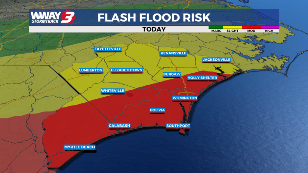
(WWAY) — A Flood Watch is active today as more rain is expected through Saturday.
A cold front stalls over the Cape Fear today and Saturday bringing occasional showers and thunderstorms… some with locally heavy rainfall. Today will bring mostly cloudy skies again with scattered showers and thunderstorms and highs in the upper 80s. We will continue to see active weather Saturday with more welcome rainfall along with occasional showers and a chance of thunderstorms with highs in the upper 80s. Rainfall amounts tonight through the beginning of the weekend could range from 2-4 inches with isolated higher totals which could lead to some flooding issues where heavy rainfall develops and lingers. In addition… any thunderstorms have a marginal potential of becoming strong or severe with damaging straight-line winds the primary concern. The front will nudge a little east and south by Sunday reducing our rain chances down to 30% for late weekend with a high in the upper 80s to near 90. For early next week… it will turn hot again with high pressure rebuilding and only a small chance of typical summer variety showers or thunderstorms and highs heating back up and into the lower to mid 90s.
WWAY FORECAST:
***A FLOOD WATCH is in effect for the Cape Fear this evening through Saturday morning. A slow moving cold front will approach and stall over southeast North Carolina through Friday. Multiple rounds heavy rainfall could produce rainfall totals of 2-4 inches with locally higher amounts possible. This could lead to excessive runoff into rivers… creeks… streams and other low-lying and flood-prone areas leading to flooding. Always remember… never drive through flooded roadways.***
Today: Mostly cloudy with scattered showers and thunderstorms. Warm and humid high in the upper 80s. Winds southwest becoming south at 5-10 mph.
Tonight: Continued mostly cloudy with occasional and a chance of thunderstorms. Muggy low in the lower 70s.
Saturday: Mostly cloudy with occasional showers and a chance of thunderstorms. Warm and humid high again in the upper 80s.
Sunday: Partly to mostly cloudy skies with temperatures into the lower 90s. isolated showers possible.
-Meteorologist Jason Korver