Isolated showers expected this afternoon
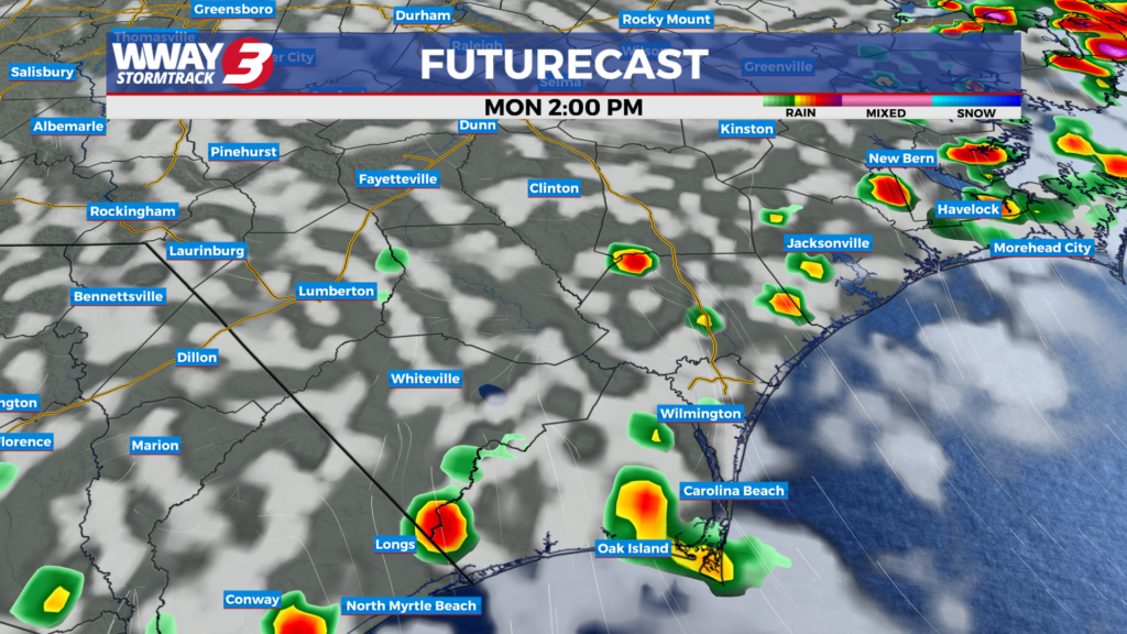
(WWAY) — Slightly below average temperatures for today as hot and humid weather returns tomorrow.
Temperatures return into the upper 80s to lower 90s with showers and thunderstorms popping up into the afternoon. The heat returns Tuesday as temperatures reach into the middle 90s as heat index values soar into the middle 90s. On Wednesday, a cold front will begin approaching the area. This feature should bring a better chance for showers and thunderstorms, although temperatures will remain seasonably hot with highs still reaching the lower to middle 90s. Overall, expect a hot and humid summer pattern to dominate this week, with heat building through the week followed by a potential increase in storm coverage as the next front moves closer.
WWAY FORECAST:
Today: A few showers and storms develop in the afternoon. Highs into the upper 80s.
Tuesday: Partly cloudy with hot and humid weather. High in the middle 90s.
Wednesday: Party cloudy skies with isolated showers and thunderstorms. Temperatures into the lower 90s.
-Meteorologist Jason Korver