Near average temperatures return for Tuesday
(WWAY) — Temperatures will return into the middle 70s today as rain chances are expected for tomorrow.
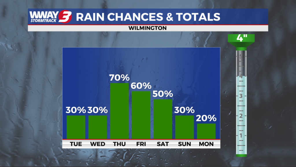
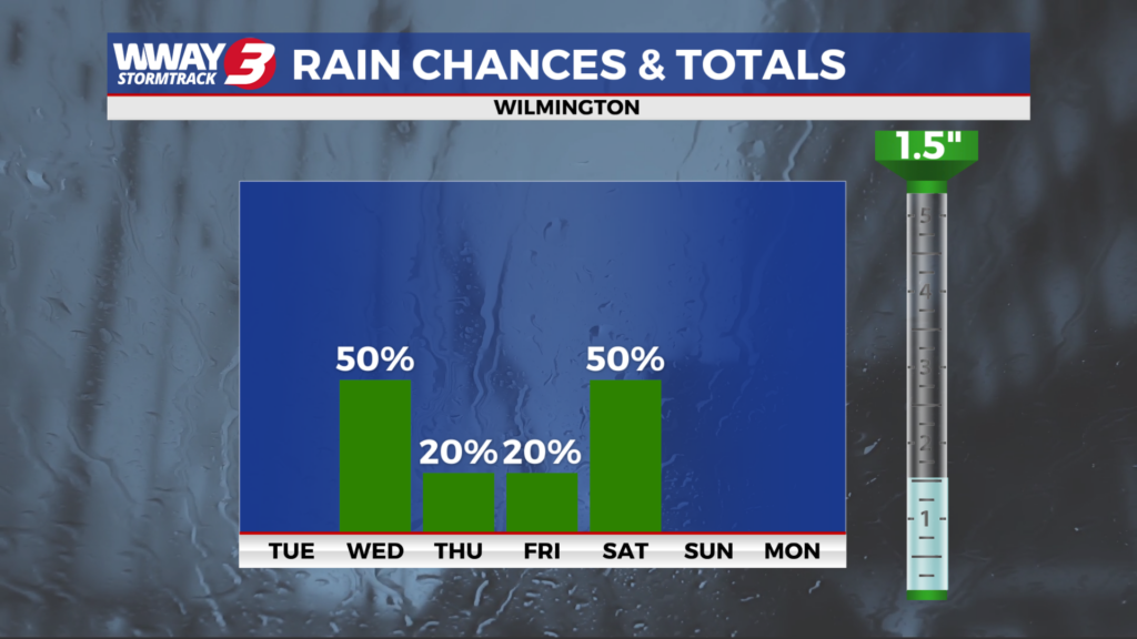
Dry weather will continue today with sunshine and scattered clouds and nice afternoon highs reaching the middle 70s. A warm front moves north of the region Wednesday while a cold front approaches and moves into the Carolinas. This will bring a return to some much needed unsettled weather with mostly cloudy skies and scattered showers and isolated thunderstorms and highs in the upper 70s. Rainfall totals could average around or a little over a quarter inch. Also… there is a marginal risk for a stronger thunderstorm with strong winds and hail the main concern. Behind this system Thursday… look for sunshine and clouds with a slight chance of a shower and seasonable highs in the upper 70s. More of the same Friday as weak high pressure ridges in from the west bringing partly cloudy skies and maybe an isolated shower and highs in the lower to mid 70s. A frontal boundary and waves of low pressure will impact the area Saturday bringing widely scattered showers and isolated thunderstorms and highs around or a little over 70. Rainfall totals Saturday and Saturday night could be healthy… up to 1 inch. High pressure builds back in Sunday into next Monday bringing a return to dry weather. Look for pleasant highs in the 70s.
WWAY FORECAST:
Today: Sunshine and scattered clouds. A nice afternoon high in the middle 70s. Winds northeast becoming south at 5-10 mph.
Tonight: Partly cloudy and comfortably cool. Low in the upper 50s.
Wednesday: Mostly cloudy with scattered showers. Isolated afternoon thunderstorms are possible. Seasonable high in the upper 70s.
Thursday: Isolated showers with temperatures into the middle 70s.