Warm temperatures continue for Tuesday
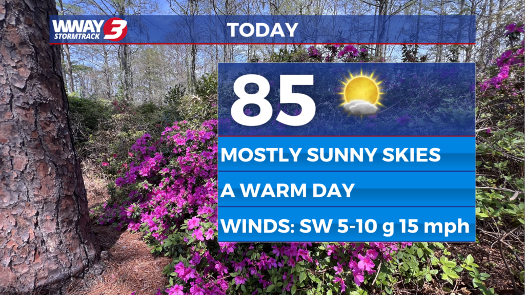
(WWAY) — Temperatures will be soaring into the middle 80s for your Tuesday.
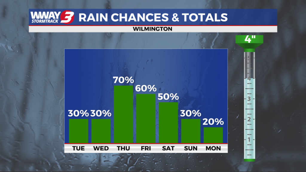
High pressure will remain in charge for the remainder of the week as well keeping dry conditions in place. Look for mostly sunny skies today and Wednesday with warmer highs in the mid 80s. Thursday will bring sunshine and clouds with highs again in the mid 80s. Friday and Saturday high temperatures soar to near record and unseasonable levels reaching the upper 80s to near 90. The daily record is 89 Friday set back in 2006 and 93 Saturday set back in 1976. Sunday a cold front advances toward the region bringing partly cloudy skies with a slight chance of showers in the afternoon into Sunday night… but rainfall is expected to be rather sparse at this point. Highs again of the front in the mid to upper 80s. Behind this front next Monday… noticeably cooler air will move in with sunshine and scattered clouds. Lows will bottom out in the lower 50s with afternoon highs in the lower 70s. Little or no rainfall is expected over the next 7 days and with moderate to severe drought in place… be very careful with flame and heed the North Carolina statewide burn burn in place. Also… water conservatively.
WWAY FORECAST:
Today: Mostly sunny and warmer. High in the mid 80s. Winds southwest becoming south at 10-15 mph.
Tonight: Becoming clear. Low in the lower 60s.
Wednesday: Abundant sunshine. Warm high in the mid 80s.
-Meteorologist Jason Korver