WEATHER DISCUSSION AND FORECAST
7/30/2026
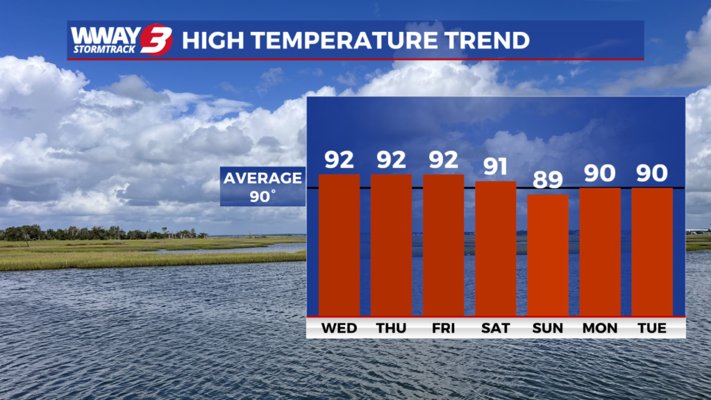
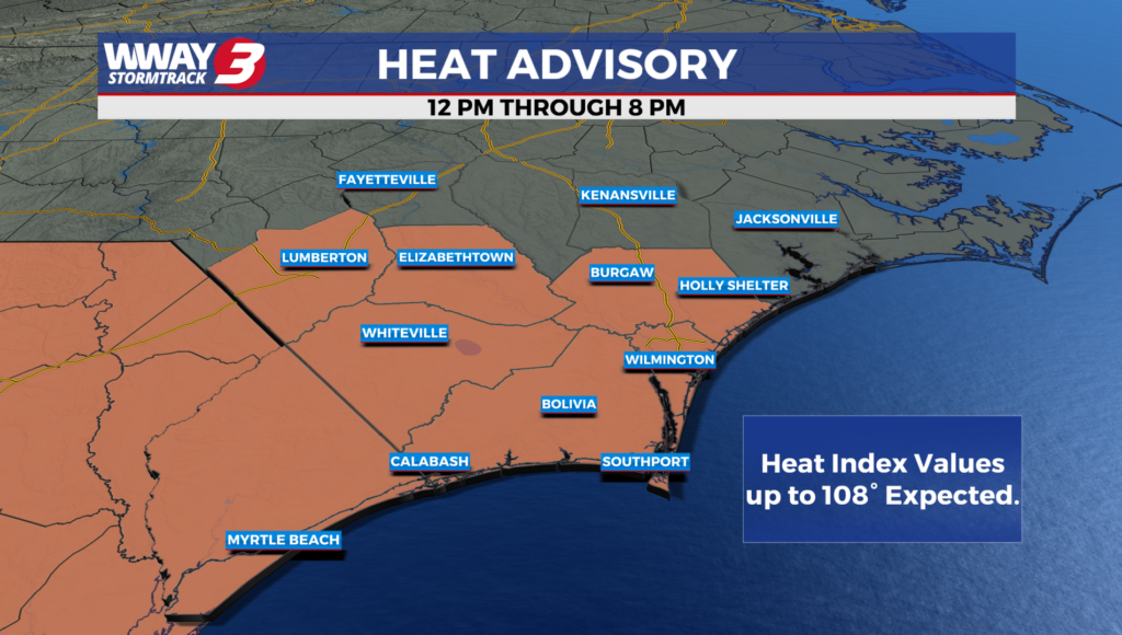
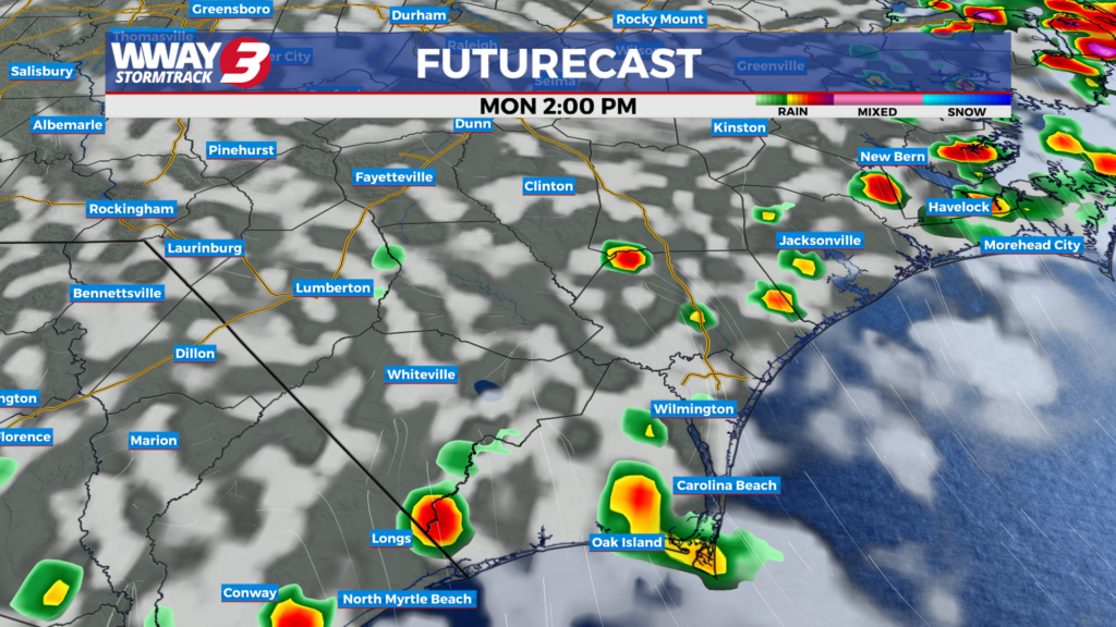
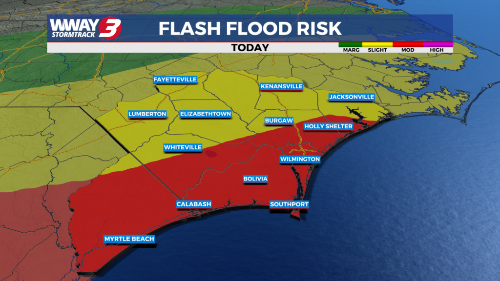
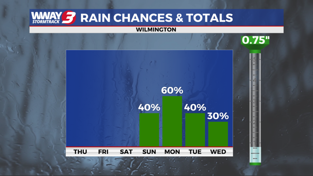
WEATHER DISCUSSION: Dew points are slightly down from yesterday as weak high pressure to the west slowly builds east. Later this week… high pressure and seasonably low humidity means quiet weather with a good deal of sunshine and a few clouds and highs in the lower 90s. By this weekend… a front that was stalled to our south moves back north increasing humidity and moisture levels… mainly Sunday. We expect sunshine and clouds mixed throughout Saturday with a high around 90 degrees. Sunday will bring partial sunshine with a chance of developing showers and thunderstorms and highs in the upper 80s to near 90. Early next week the front washes out with seasonable heat and humidity along with widely scattered to scattered daily showers and thunderstorms. Highs will continue to be seasonable around 90 degrees.
WWAY FORECAST:
Tonight: Fair skies. Comfortable low near 70.
Friday: Mostly sunny skies. Continued pleasant humidity with a rather hot high in the lower 90s.
Saturday: Partly to mostly sunny skies with temperatures into the lower 90s.
Saturday Night: Partly cloudy skies with a 20% chance of isolated showers. Lows in the mid 70s.
-Meteorologist Cicily Hammers
To view the full 7-day forecast, click HERE.
You can follow the StormTrack 3 weather team on social media!
Chief Meteorologist Lee Haywood: FACEBOOK – X (TWITTER)
Meteorologist Jason Korver: FACEBOOK – X (TWITTER)
Meteorologist Charles McKeller: FACEBOOK–X (TWITTER)
Meteorologist Cicily Hammers: FACEBOOK – X (TWITTER)
Keep track of the very latest StormTrack 3 forecasts and anytime severe weather threatens the area on Facebook and Twitter, and on-air by streaming us live!
Weather Maps

Local Temperatures

Current Winds

Regional Temps

Feels Like Temps

Local Radar

Carolinas Satellite/Radar

Southeast Satellite/Radar

Beach Forecast