Dry and sunny weather for Wednesday
(WWAY) — Temperatures warm up to near average today as sunny skies return.
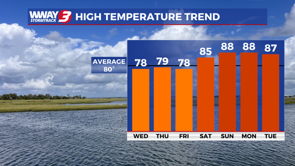
Today will bring sunshine and scattered clouds ahead of the next cold front with milder highs in the upper 70s. Rainfall trends have decreased in association with a weak cold front tonight with only a slight chance of late night showers. Behind this front… mostly sunny skies Thursday with seasonable highs in the upper 70s to near 80. High pressure builds across the region Friday and then offshore this weekend bringing mainly sunny skies with a warming trend. Look for highs reaching the upper 70s Friday… reaching the middle 80s Saturday and heating into the upper 80s Sunday. The high pressure remains anchored offshore early next week keeping dry… very warm and muggy weather in place. Look for highs next Monday and Tuesday in the upper 80s. Little to no rainfall is expected over the next 7 days.
WWAY FORECAST:
Today: Sunshine and scattered cloudiness. A pleasant day with a high in the upper 70s. Winds east at 5-10 mph.
Tonight: Partly cloudy with a slight chance of late-night showers. Comfortable low around or a little over 60.
Thursday: Becoming mostly sunny. Seasonable high in the upper 70s to near 80.
Friday: Mostly sunny skies with temperatures into the upper 70s.
-Meteorologist Jason Korver