Rain chances are expected for Memorial Day weekend
(WWAY) — After a dry week, rain chances return just in time for Memorial Day weekend.
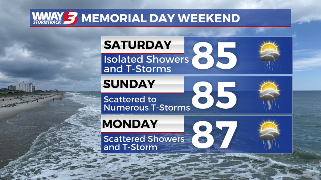
A front will be stalled in the vicinity today leading to widely scattered showers and thunderstorms under clouds and partial sunshine with highs in the mid 80s. While the front does move back north for the Memorial Day weekend… it will remain unsettled with a continued chance of showers and thunderstorms Saturday and scattered showers and thunderstorms Sunday. Look for highs both days reaching the middle 80s. A steady stream of moisture will remain in place early next week leading to a continued chance of daily showers or thunderstorms with a rather typical summertime pattern in place. It will likely be very warm with highs reaching the upper 80s for Memorial Day through the middle of next week.
WWAY FORECAST:
Today: Clouds and partial sunshine with a chance of showers and thunderstorms. Rather warm high in the mid 80s. Winds south becoming southeast around 10 mph.
Tonight: Variable cloudiness with a continued chance of showers and isolated thunderstorms. Warm and muggy low around 70.
Saturday: Mostly cloudy with widely scattered showers and thunderstorms. Rather warm again with a high in the mid to upper 70s.
Sunday: Scattered showers and thunderstorms. Temperatures into the middle 80s.
-Meteorologist Jason Korver