Cooler temperatures return for today
(WWAY) — After a cold front brought much needed rain, temperatures will be cooler this afternoon.
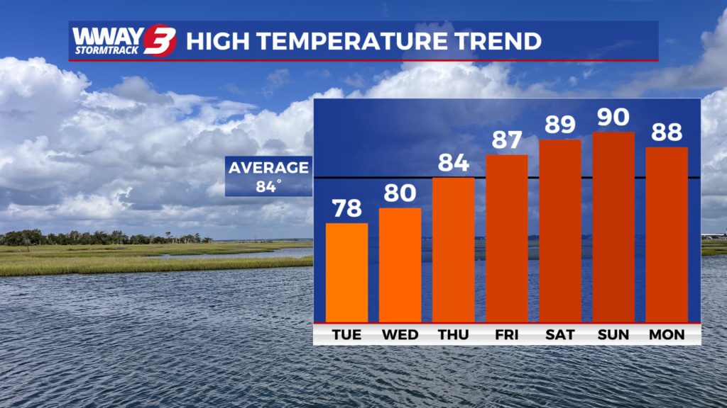
A drier and noticeably less humid airmass move into the region today after a cold front moved through last night, with afternoon temperatures generally topping out in the mid to upper 70s. Surface high pressure will then become established across the Carolinas through the remainder of the workweek. By the weekend, the center of high pressure is expected to shift offshore, allowing a return of tropical flow to develop across the southeastern United States. This pattern will usher in increasing moisture and humidity while supporting a gradual warming trend. Afternoon highs are forecast to climb into the mid and upper 80s Saturday, with lower 90s possible by Sunday.
WWAY FORECAST:
Today: Gradual clearing in the afternoon. Temperatures into the middle to upper 70s. Winds NE 10-20 mph.
Wednesday: Mostly sunny skies with temperatures into the upper 70s.
Thursday: Mostly sunny with seasonable temps in the mid 80s.
-Meteorologist Jason Korver