Hot and humid for today with increasing rain chances tonight
(WWAY) — Hot and humid weather for today as a cold front brings a chance of severe weather for tonight.
A cold front will start approaching the Carolinas today bringing hot and humid weather locally with a slight chance of afternoon showers or thunderstorms and highs in the lower to mid 90s. The cold front moves across the region tonight bringing with it scattered showers and thunderstorms under mostly cloudy skies. The Storm Prediction Center has a slight risk of severe thunderstorms (level 2/5) with the main threat damaging wind gusts but an isolated tornado can’t be ruled out. Behind this front on Wednesday… lowering humidity and dry weather builds in with sunshine and scattered clouds with highs again in the lower to mid 90s. Late this week… high pressure and seasonably lower humidity means quiet weather with a good deal of sunshine and a few clouds and highs in the lower 90s. By this coming weekend… the front stalled to our south moves back north increasing humidity and moisture levels and bringing a chance of showers and thunderstorms… mainly Sunday. Otherwise near seasonable temps are expected from 91-92 with sunshine and clouds each day.
WWAY FORECAST:
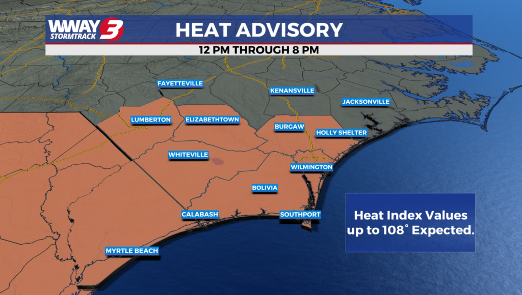
***A HEAT ADVISORY is in effect for New Hanover… Brunswick and Columbus counties today from noon to 8pm. Heat index values through early evening could reach as high as 108. Hot temperatures and high humidity may lead to heat illnesses if proper precautions are not taken. Drink plenty of fluids… stay in an air-conditioned location… stay out of the sun and check up on relatives and neighbors. Make sure pets are taken care of and have shade and plenty of water.***
Tuesday: Hot and humid. Sunshine and cloudiness with isolated afternoon showers or thunderstorms. High in the lower to mid 90s. Afternoon heat index values reaching as high as 102-107. Winds southwest becoming south at 5-15 mph.
Tuesday Night: Mostly cloudy skies with scattered showers and thunderstorms. There is a slight risk of severe thunderstorms with damaging winds and perhaps an isolated tornado. Warm and muggy low in the mid to upper 70s.
Wednesday: Sunshine and scattered clouds. Lower humidity develops. Hot high in the lower to mid 90s.
Thursday: Mostly sunny skies with temperatures into the lower 90s
-Meteorologist Jason Korver