Great weather continues for Thursday
(WWAY) — Nice weather is expected as sunny skies return for today.
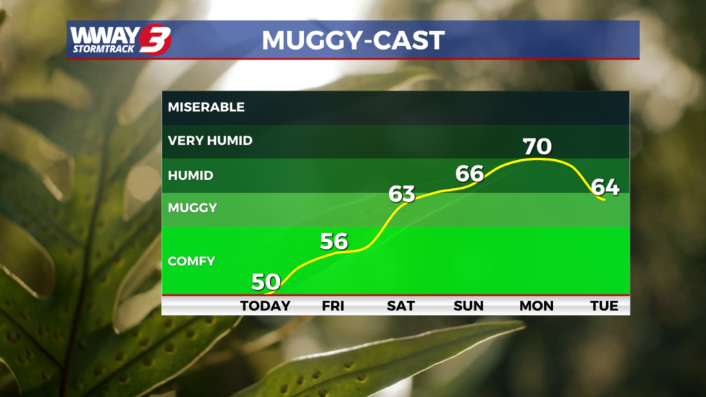
Surface high pressure will dominate the Carolinas today bringing sunny skies with seasonable highs in the lower to mid 80s along with low humidity air. The high pressure remains across the Carolinas and offshore Friday allowing for a warmer S/SW wind and mostly sunny skies with highs reaching the upper 80s. This weekend… the high pressure is expected to fully shift offshore allowing a return of tropical flow across the southeastern United States. This pattern will usher in increasing moisture and humidity while supporting a continued gradual warming trend. Look for sunshine and clouds mixed both Saturday and Sunday with highs reaching the upper 80s and pushing to 90 by Sunday. A cold front swings through the region Monday bringing a few showers or thunderstorms with it and highs again in the upper 80s. Behind this cold next Tuesday and Wednesday temps will drop off into the lower 80s and with enough lingering moisture there will be a slight chance of daily showers or a thunderstorm.
WWAY FORECAST:
Tonight: Sunny skies. A nice and seasonable afternoon high in the lower to mid 80s. Winds north becoming east around 10 mph.
Tonight: Clear and comfortable. Low near 60.
Friday: Mostly sunny and warmer. High in the upper 80s.
Saturday: Partly to mostly sunny skies with temperatures into the upper 80s
-Meteorologist Jason Korver