Hot and dry temperatures for Thursday
(WWAY) — Temperatures return back into the middle 80s today as dry weather continues.
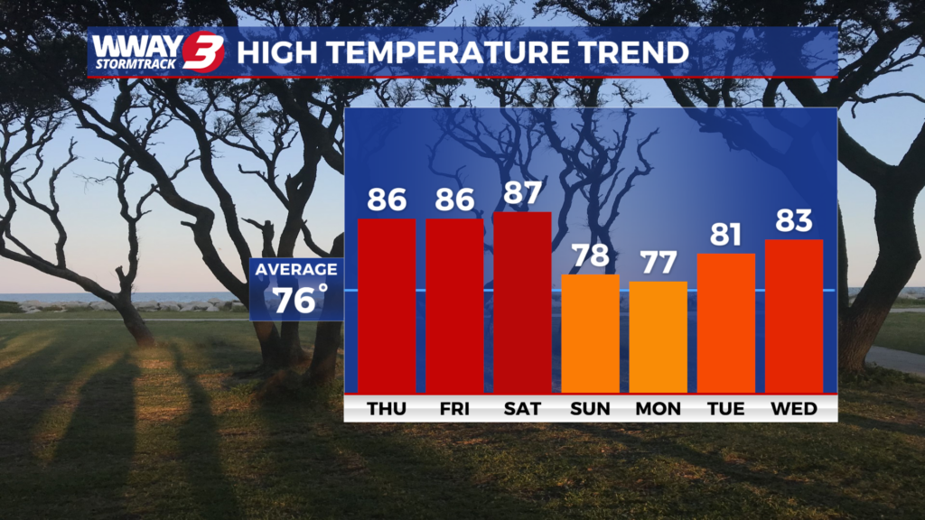
More dry weather lingers today with a good deal of sunshine and warm highs in the mid 80s.
Not much change Friday with mostly sunny skies continuing and warm highs in the mid to upper 80s.
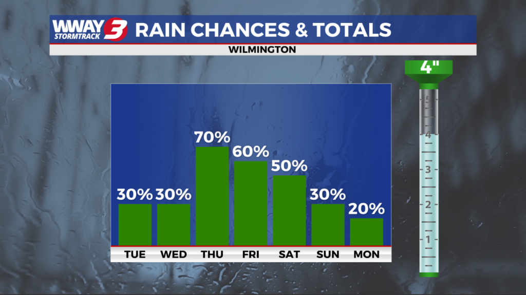
A cold front will approach and then move through the Carolinas this coming weekend bringing a chance of much needed showers or a thunderstorm… mainly Saturday evening and night and Sunday.
Highs will reach the very warm upper 80s Saturday before dropping back into the upper 70s Sunday.
Behind this cold front Monday… weak high pressure will build down from the north bringing mainly dry weather with only a slight chance of a shower and highs again in the upper 70s. Rain chances go back up again Tuesday with clouds and partial sunshine along with widely scattered showers and perhaps an isolated thunderstorm with highs in the lower 80s.
Light rainfall totals continue over the next 7 days… with a half to three quarter inch of rain expected. Unfortunately… it will not be enough to relieve the ongoing severe drought in place.
WWAY FORECAST:
Today: Plenty of sunshine and a few clouds mixed. Warm high in the mid 80s. Winds west becoming southwest at 10-15 mph.
Tonight: Mainly clear skies. A pleasant low around 60.
Friday: Mostly sunny skies. Continued warm and dry with a high in the mid to upper 80s.
Saturday: Partly sunny skies with temperatures into the middle to upper 80s. Increasing rain chances expected Saturday night.
-Meteorologist Jason Korver