Hot temperatures return to the Cape Fear today
(WWAY) — Temperatures return to the 90s today as warmer weather is expected this weekend.
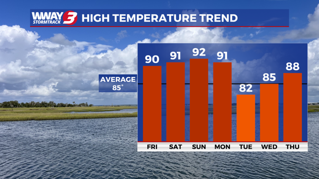
The high pressure remains across the Carolinas and offshore today allowing for a warmer SW breeze and plentiful sunshine with very warm highs reaching the upper 80s to near 90. This weekend… the high pressure is expected to fully shift offshore allowing a return of tropical flow across the southeastern United States. This pattern will usher in increasing moisture and humidity while supporting a continued warming trend. Look for sunshine and clouds mixed both Saturday and Sunday with highs reaching around 90 Saturday and the hot and humid lower 90s Sunday. A cold front swings through the region Monday bringing a few showers or thunderstorms with it and rather hot highs around 90. Behind this cold next Tuesday and Wednesday temps will drop off into the more seasonable lower to mid 80s and with enough lingering moisture there will be a slight chance of a shower… mainly next Tuesday. Otherwise look for partly cloudy skies to prevail
WWAY FORECAST:
Today: Plenty of sunshine. A warmer high in the upper 80s to near 90. Winds west becoming south at 5-10 mph.
Tonight: Becoming partly cloudy. A little more humid with a mild low in the mid to upper 60s.
Saturday: Sunshine and scattered clouds. A rather hot and humid high around 90.
Sunday: Partly to mostly sunny skies with temperatures into the lower 90s.
-Meteorologist Jason Korver