Increasing rain chances expected for Easter Sunday
(WWAY) — You might need your umbrellas this weekend as a cold front is expected to move through on Easter.
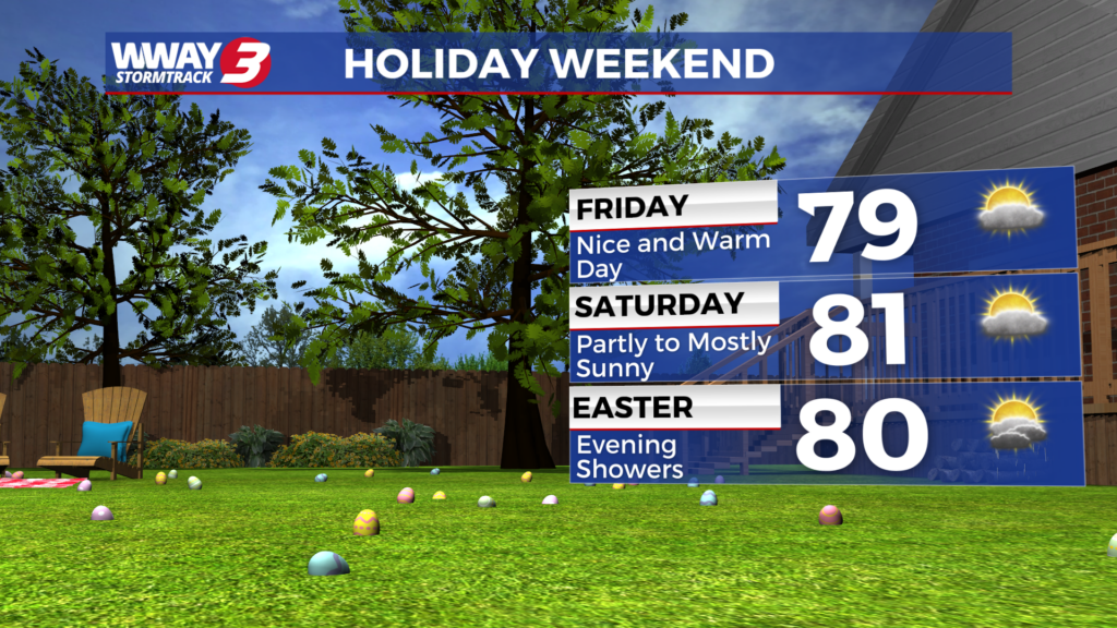
Very little change is expected today and Saturday with sunshine and clouds and more nice and warm highs around or a little over 80. An isolated shower can’t be ruled out mainly interior southeast North Carolina each day but most areas remain dry.
Increasing rain chances are expected as we get into Easter Sunday and Sunday night as a cold front approaches the region. You may need the umbrella at times especially in the afternoon into Sunday night when the highest rain chances develop. Isolated thunderstorms will be possible as well. Otherwise look for partly sunny skies Sunday with highs around 80.
Behind the cold front Monday, any isolated showers end early in the day with mostly cloudy skies lingering and cooler highs in the upper 60s to near 70.
It will likely remain mostly cloudy next Tuesday with near seasonable weather and a high again in the upper 60s to near 70. Strong high pressure from the north ridges down and into region next Wednesday bringing back mostly sunny skies with a cool high in the middle 60s. Overnight lows next Tuesday and Wednesday morning will be in the cool 40s.
WWAY FORECAST:
Today: Sunshine and clouds mixed. A slight chance of a shower inland. A pleasant spring day with a high around 80. Winds southeast becoming south at 10-15 mph.
Tonight: Mostly clear and continued comfortable. Low around 60.
Saturday: Sunshine and scattered clouds. Warm high around or a little over 80.
Sunday: Showers and a chance of storms into the afternoon and evening. Temperatures into the lower 80s.
-Meteorologist Jason Korver