Rainy weather today as cold front moves through
(WWAY) — A cold front brings much needed rain to the Cape Fear.
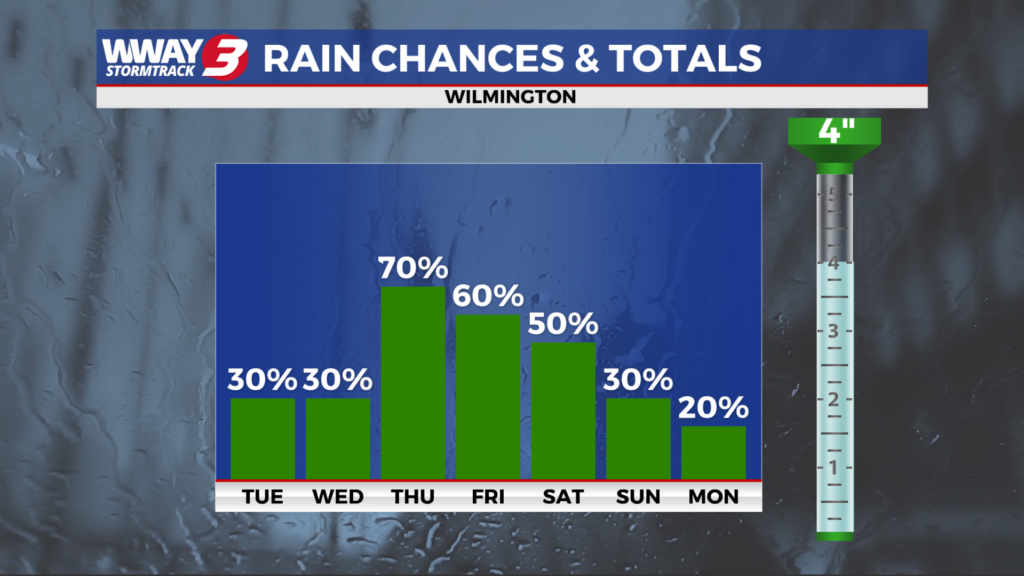
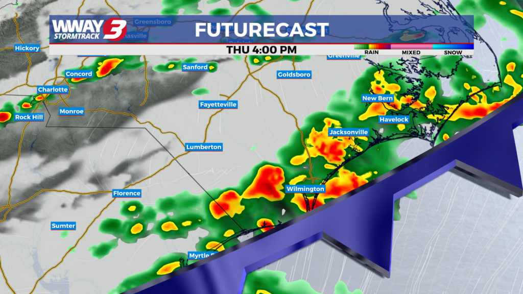
A cold front approaches today and moves through late in the day or in the evening. It will bring back some much needed rain chances with scattered showers and a chance of thunderstorms with highs in the upper 70s to near 80. Behind this front Friday… weak high pressure builds in bringing cooler highs and drier air. Look for partly cloudy skies and highs in the lower 70s. Saturday will bring a chance of rain showers and seasonable highs around 80. Rain forecast amounts Thursday through Saturday could range from a half inch to one inch. A continued somewhat unsettled pattern Sunday with a few showers possible and a small thunderstorm risk with a warmer high in the lower 80s. Despite the rain chances this weekend… there should be plenty of dry time mixed with any rain chances. Another cold front swings through the region next Monday bringing scattered showers and a chance of thunderstorms with highs again in the lower 80s. Behind this cold front… high pressure builds across the region next Tuesday and Wednesday bringing dry weather with increasing sunshine and highs reaching the upper 70s to around 80.
WWAY FORECAST:
Today: Mostly cloudy and breezy with scattered showers and isolated thunderstorms. High in the upper 70s to near 80. Winds southwest becoming west at 10-20 mph with occasional gusts to 25 mph.
Tonight: Scattered showers early. Mostly cloudy skies. Cooler and less humid late with a low in the mid to upper 50s.
Friday: Clouds and sunshine mixed. Dry and a little cooler with below average high in the lower 70s.
Saturday: Partly to mostly cloudy with isolated to scattered shower chances. Temperatures into the middle to upper 70s.
– Meteorologist Jason Korver