Slightly cooler temperatures expected today
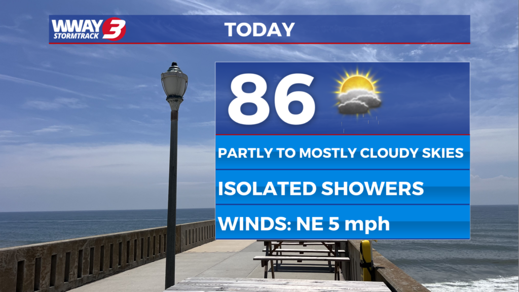
(WWAY) — Temperatures will be cooler today with a slight chance of showers this afternoon.
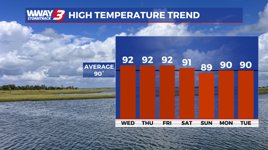
WEATHER DISCUSSION: Today, a cold front will likely move back north in the afternoon but temps and humidity levels will be seasonable. Look for mostly cloudy skies with a few mainly afternoon showers or thunderstorms and highs in the mid to upper 80s. It will be warmer and more humid Wednesday as high pressure takes control with sunshine and clouds and highs in the upper 80s to near 90 with isolated showers or thunderstorms possible. We expect hot and humid Thursday with no rain relief expected as highs reach the mid 90s. A cold front combined with tropical moisture and an approaching area of low pressure will bring scattered showers and thunderstorms Friday with highs in the lower 90s. The low pressure and front exit this coming weekend as drier air builds in behind it along with weak high pressure. Look for a slight chance of showers and thunderstorms Saturday with highs in the upper 80s to near 90. Sunday will be mostly sunny with highs reaching the lower 90s.
WWAY FORECAST:
Today: Mostly cloudy with isolated showers or thunderstorms. Not as hot with a high in the mid to upper 80s. Winds north becoming southwest at 5-10 mph.
Tonight: Partly cloudy skies. Low near 70.
Wednesday: Sunshine and clouds. Increasing heat and humidity. A slight chance of an afternoon shower or thunderstorm. High in the upper 80s to near 90.
Thursday: Hot and humid with mostly sunny skies. Temperatures into the lower to middle 90s.
-Meteorologist Jason Korver