Temperatures continue to warm up today
(WWAY) — Expect to see cloudy skies today with temperatures back into the upper 80s.
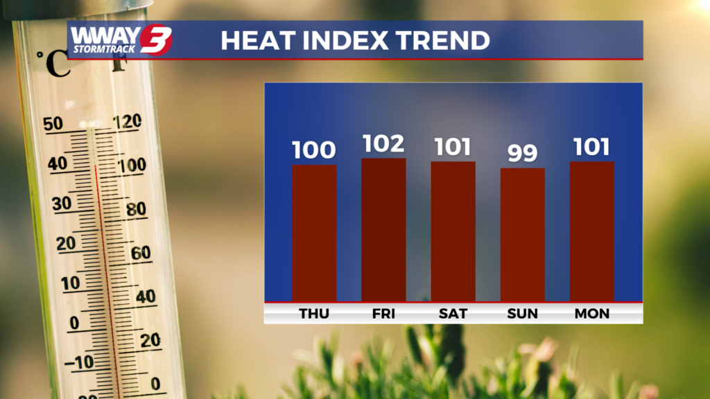
Today will continue the mainly dry weather with clouds and partial sunshine. It will start to heat back up with highs in the upper 80s to near 90. By late week… summerlike conditions will strengthen once again as Atlantic high pressure rebuilds with a mixture of sunshine and clouds and highs with a slight chance of a shower or thunderstorm. Highs Thursday reach the lower 90s with heat indices reaching the upper 90s. Friday will be hot and humid with highs in the mid 90s and heat indices as high as 102-106. Another front will approaches the Carolinas and is likely to stall. The deeper moisture flowing in will combine with the front to bring a better chance of showers and thunderstorms Saturday and Sunday with highs in the lower 90s. With a couple of fronts in the vicinity early next week… our weather will remain unsettled with widely scattered daily showers and thunderstorms next Monday and Tuesday as highs reach the lower 90s.
WWAY FORECAST:
Today: Clouds and partial sunshine. Heating up again with a very warm and humid high in the upper 80s to near 90. Heat index values in the afternoon reaching around or a little over 90. Winds southwest becoming south around 10 mph.
Tonight: Scattered cloudiness. A slight chance of a passing shower late. Warm and muggy low in the lower 70s.
Thursday: Sunshine and scattered clouds with isolated showers or thunderstorms possible. Hot and humid high in the lower 90s. Heat index values in the afternoon reaching the upper 90s.
Friday: Partly cloudy skies with temperatures into the lower to middle 90s. Isolated showers chances.
-Meteorologist Jason Korver