New Hanover, Pender County is under Tornado Warning until 5 p.m.
New Hanover and Pender County are currently under a Tornado Warning, until 5 p.m. Affected areas include Murraysville, Ogden, Hampstead, and Kings Grant.


Beach Forecast

Coastal & Offshore Radar

7 Day Forecast
New Hanover and Pender County are currently under a Tornado Warning, until 5 p.m. Affected areas include Murraysville, Ogden, Hampstead, and Kings Grant.

As dangerous heat and humidity continue across much of the South, pet owners are being reminded to take extra precautions to protect dogs and cats from heat-related dangers.
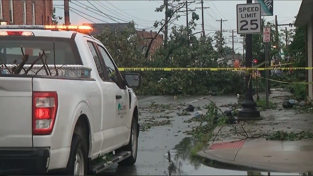
A 4-year-old boy was killed when a tree toppled on his home in Indiana on Tuesday amid an outbreak of severe weather that spawned at least five confirmed tornadoes and produced strong winds that downed power lines and ripped roofs off homes.
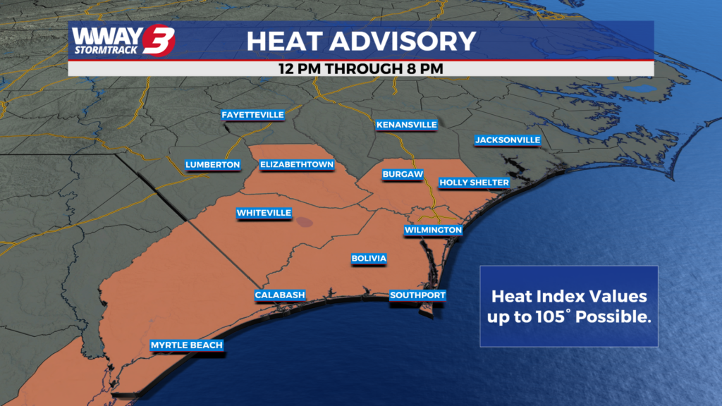
Temperatures rise back into the middle 90s this afternoon.
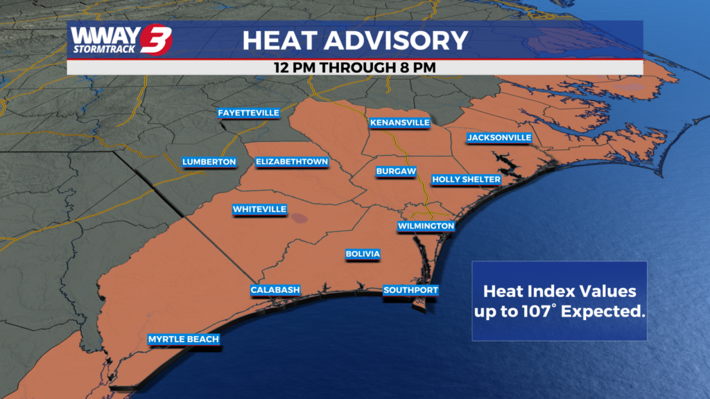
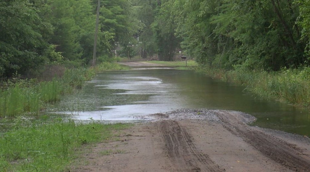
Recent rainfall has improved drought conditions across much of North Carolina, but most of the state remains in moderate to severe drought, according to the latest U.S. Drought Monitor report released Thursday.
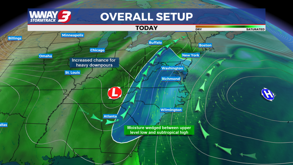
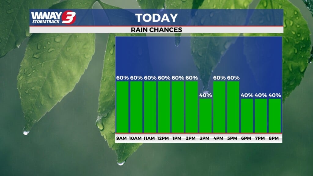
Rain chances continue this morning as dry weather is expected later this week.

Wildfires are burning in North America and Europe. Deadly heat waves have parked over cities and the world's oceans are the hottest ever recorded for this time of year. A strengthening El Nino is forecast to be off-the-charts, spiking global temperatures and warping weather all over.
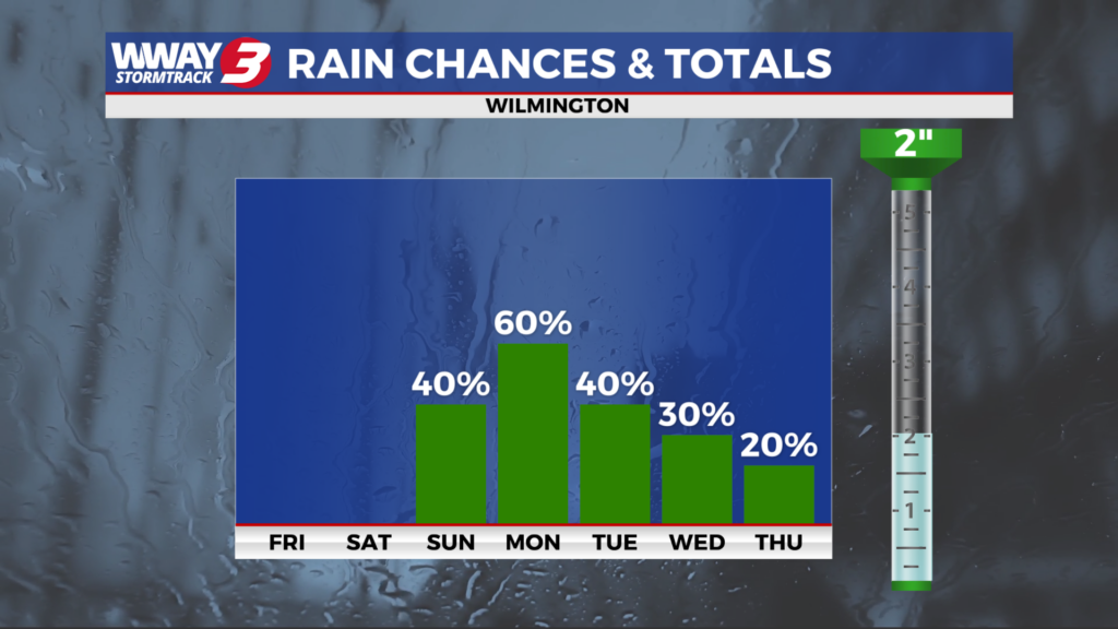
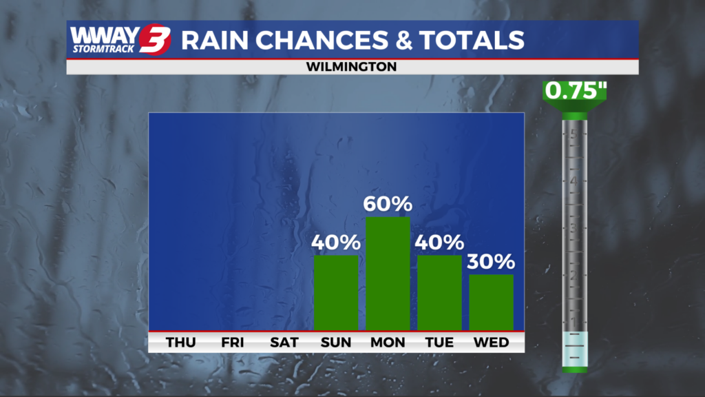
Dry weather and pleasant dew points is expected heading into the weekend.
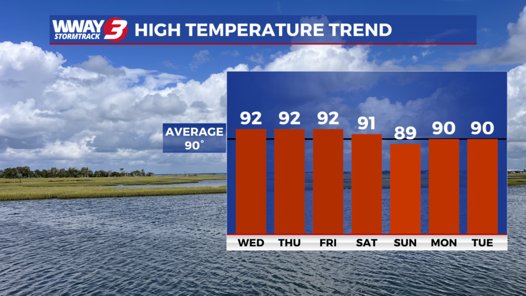

A destructive tornado ripped through parts of Wisconsin on Monday afternoon, with images from the affected area showing toppled trees and power lines and damaged buildings.
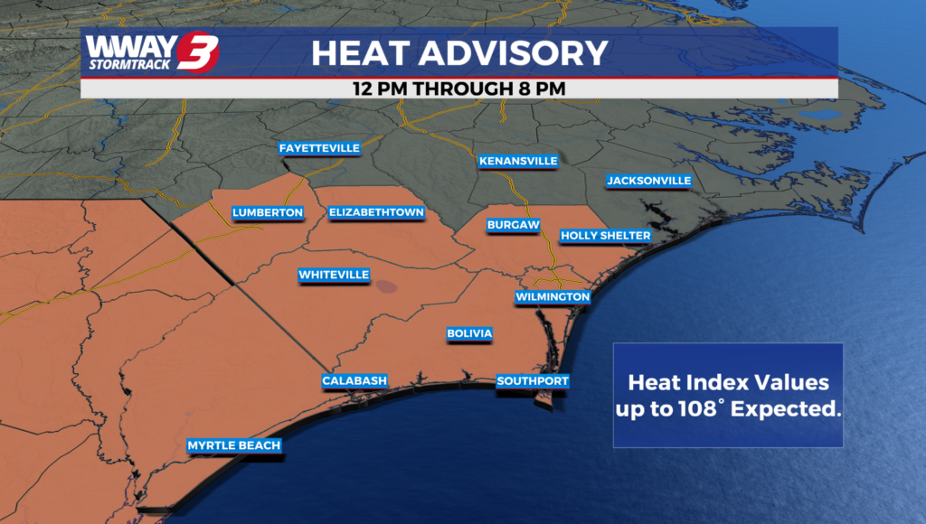
Hot and humid weather for today as a cold front brings a chance of severe weather for tonight.
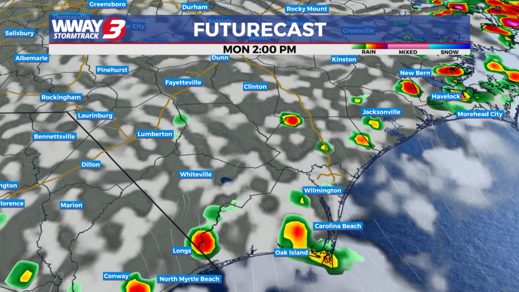
Slightly below average temperatures for today as hot and humid weather returns tomorrow.
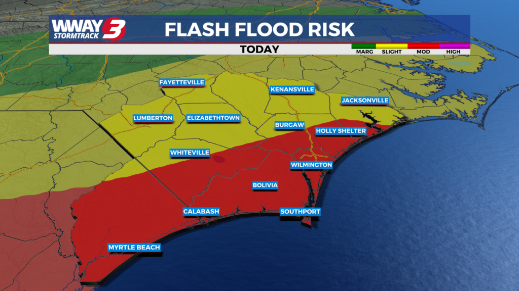
A Flood Watch is active today as more rain is expected through Saturday.
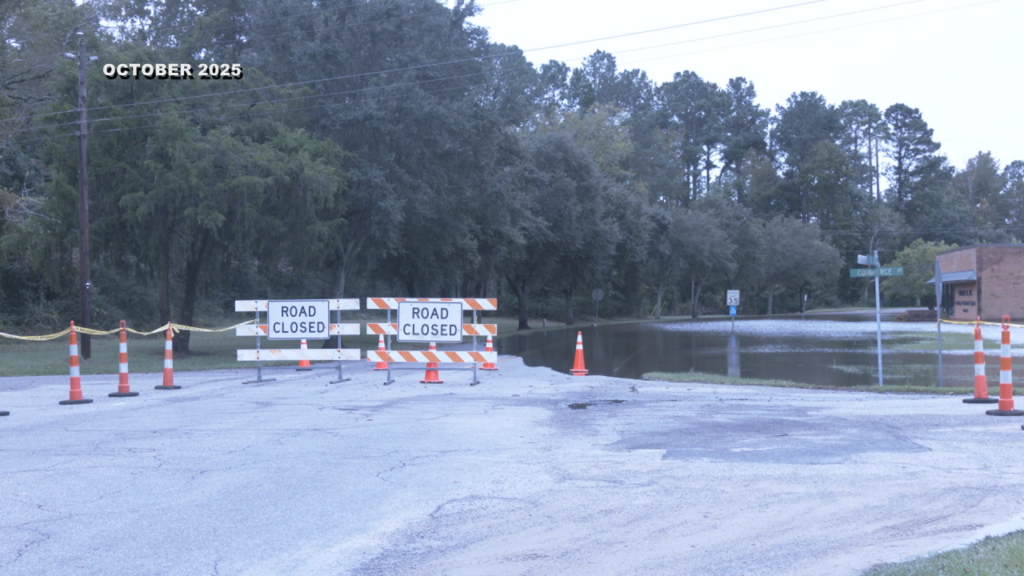
A flood watch is in effect across the Cape Fear region through Friday afternoon as forecasters warn that between two and four inches of rain could lead to localized flooding, particularly in low-lying and flood-prone areas.
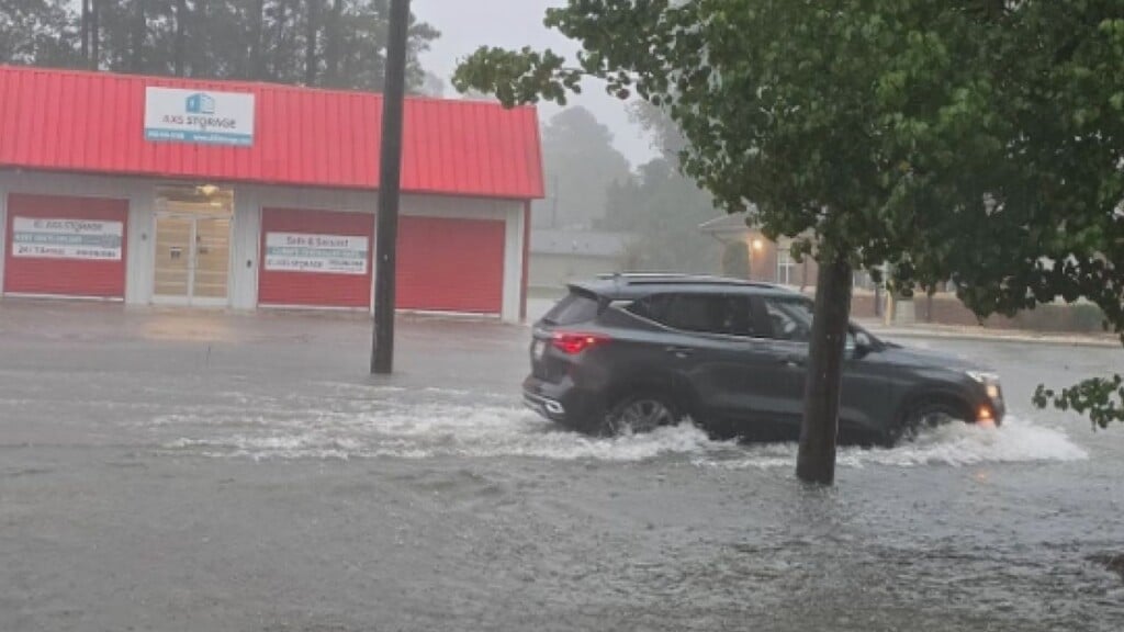
The National Weather Service has issued a Flood Watch for much of southeastern North Carolina as forecasters warn that several rounds of heavy rain could bring flash flooding through the weekend.
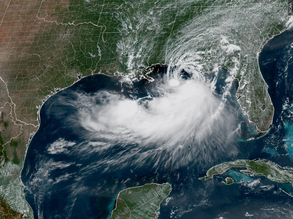
Tropical Storm Bertha moves into Louisiana, heads for Texas. See forecast map and its path.
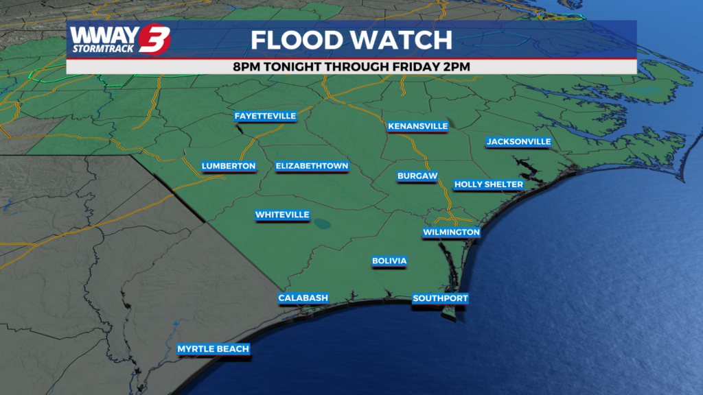
Rain will be back into the forecast over the next couple of days as a cold front stalls over the Cape Fear.
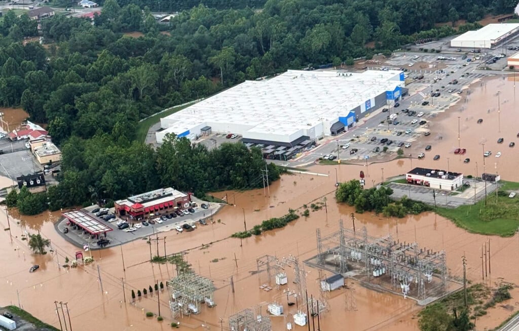
Torrential rains caused flash floods in West Virginia that inundated homes and businesses, washed out bridges and led to numerous water rescues. The state's governor said that some residents were unaccounted for as search operations continued.
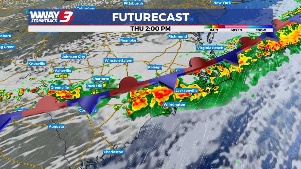
Hot and humid weather continues today as rain chances increase towards the end of the week.

A tornado watch is in effect from Delaware to Philadelphia to New York City to upstate New York as severe thunderstorms and torrential downpours pound the Northeast on Tuesday afternoon and evening.
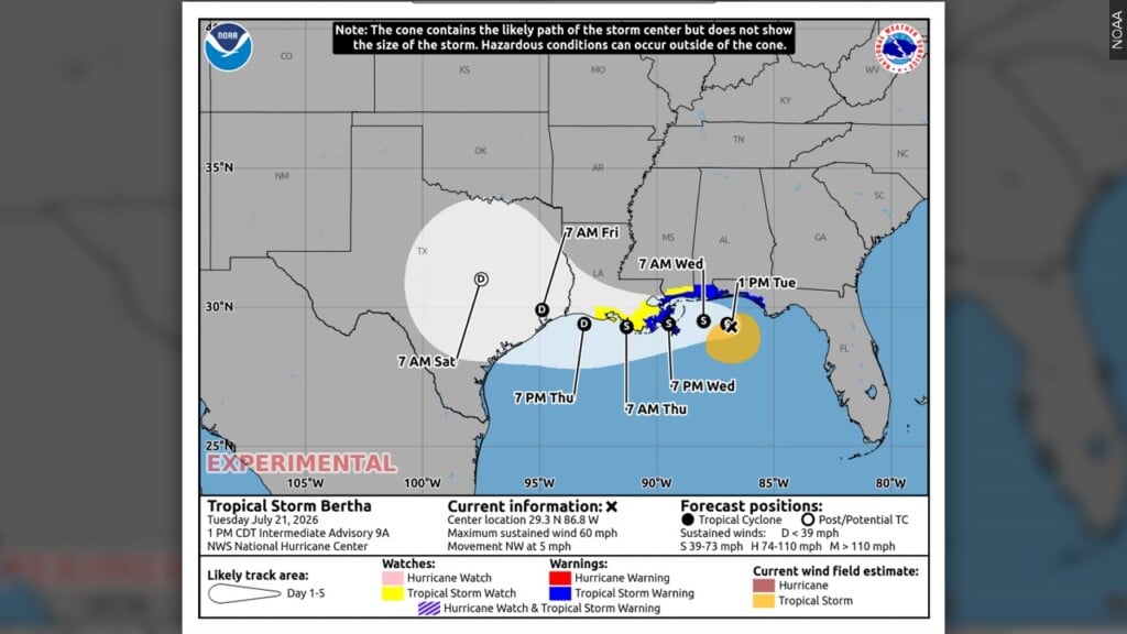
Tropical Storm Bertha strengthened in the Gulf of Mexico on Tuesday but was expected to weaken as it chugs closer to the U.S., potentially bringing coastal flooding and heavy rain from the Florida Panhandle to Louisiana. Those a