Heavy rain showers continues through Saturday
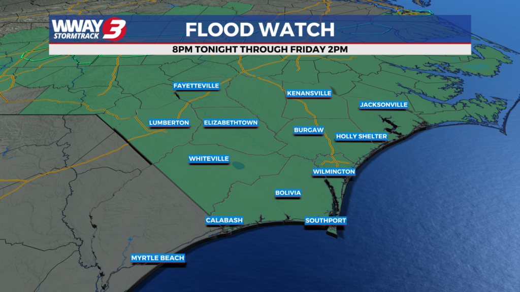
A Flood Watch is active today as more rain is expected through Saturday.


Beach Forecast

Coastal & Offshore Radar

7 Day Forecast
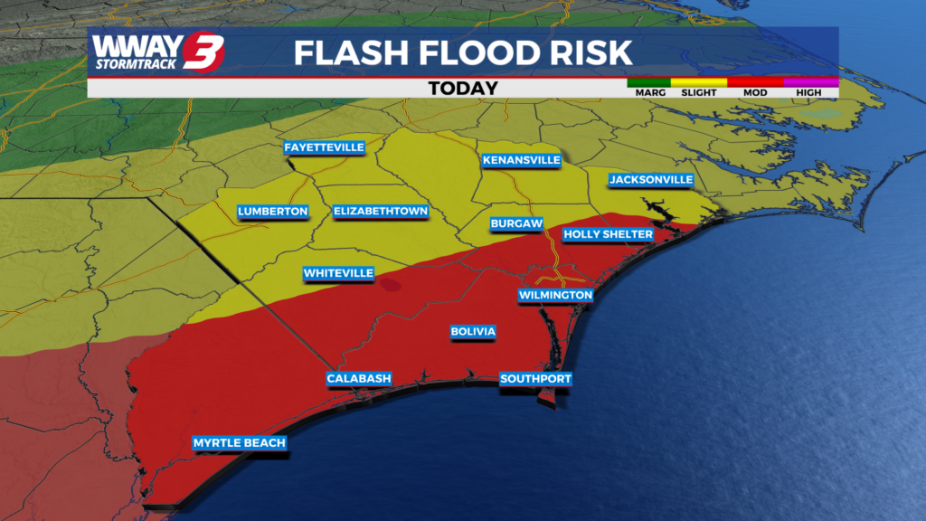
A Flood Watch is active today as more rain is expected through Saturday.
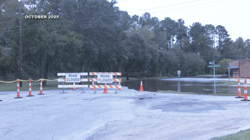
A flood watch is in effect across the Cape Fear region through Friday afternoon as forecasters warn that between two and four inches of rain could lead to localized flooding, particularly in low-lying and flood-prone areas.
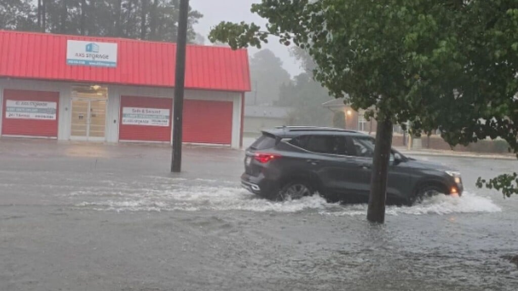
The National Weather Service has issued a Flood Watch for much of southeastern North Carolina as forecasters warn that several rounds of heavy rain could bring flash flooding through the weekend.
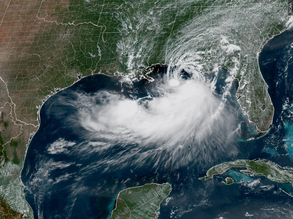
Tropical Storm Bertha moves into Louisiana, heads for Texas. See forecast map and its path.
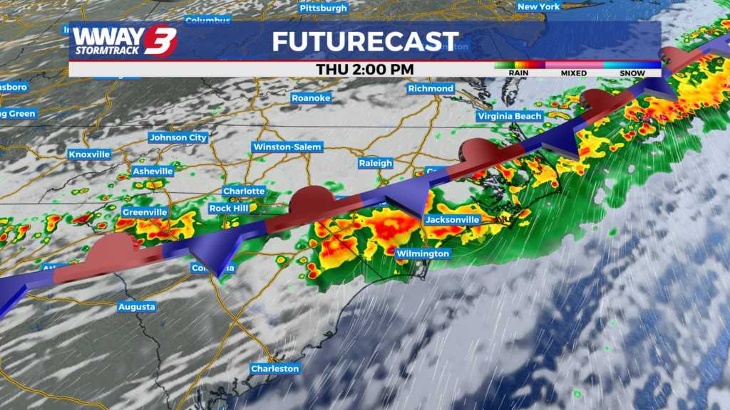
Rain will be back into the forecast over the next couple of days as a cold front stalls over the Cape Fear.

Torrential rains caused flash floods in West Virginia that inundated homes and businesses, washed out bridges and led to numerous water rescues. The state's governor said that some residents were unaccounted for as search operations continued.
Hot and humid weather continues today as rain chances increase towards the end of the week.

A tornado watch is in effect from Delaware to Philadelphia to New York City to upstate New York as severe thunderstorms and torrential downpours pound the Northeast on Tuesday afternoon and evening.
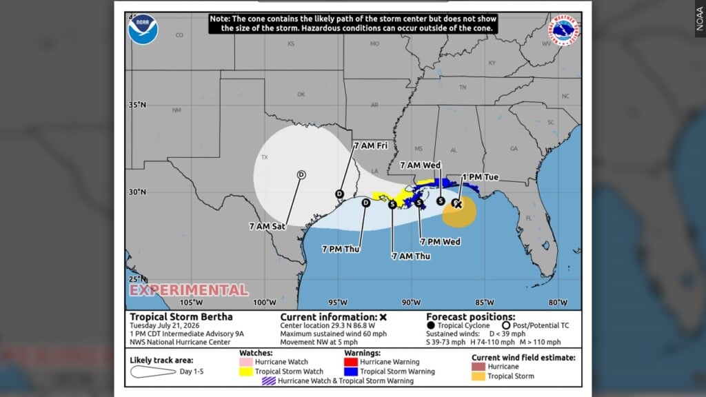
Tropical Storm Bertha strengthened in the Gulf of Mexico on Tuesday but was expected to weaken as it chugs closer to the U.S., potentially bringing coastal flooding and heavy rain from the Florida Panhandle to Louisiana. Those a
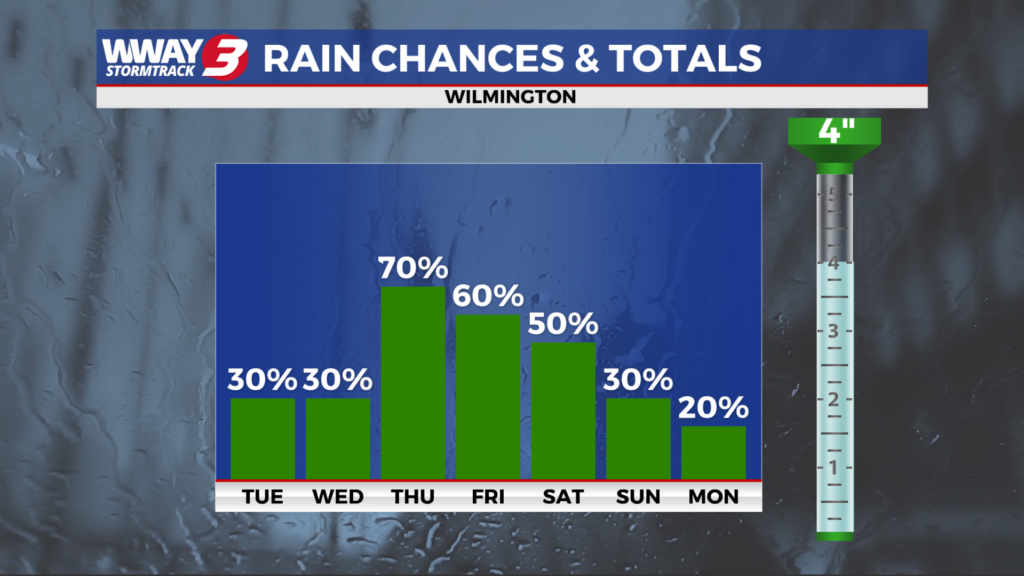
Shower chances are increasing later this week as weather today remains hot and humid.
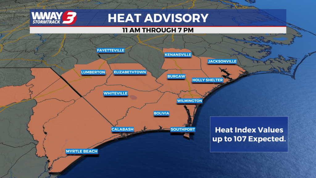
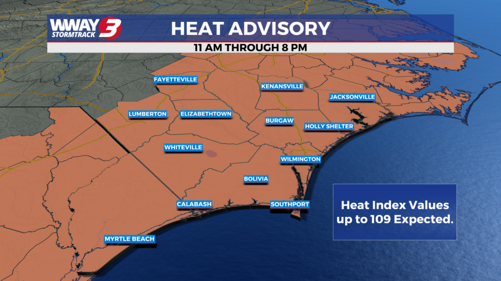
A Heat Advisory has been issued for today as hot and humid continues.

Rescuers in boats and helicopters saved dozens of stranded drivers and people trapped in homes from catastrophic flooding that hit parts of Texas overnight while many more fled to higher ground Thursday in a region still reeling from devastating floods a year ago.
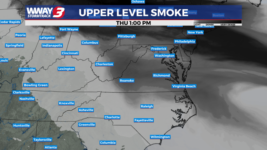
Wildfire haze returns today as temperatures rise into the middle 90s.
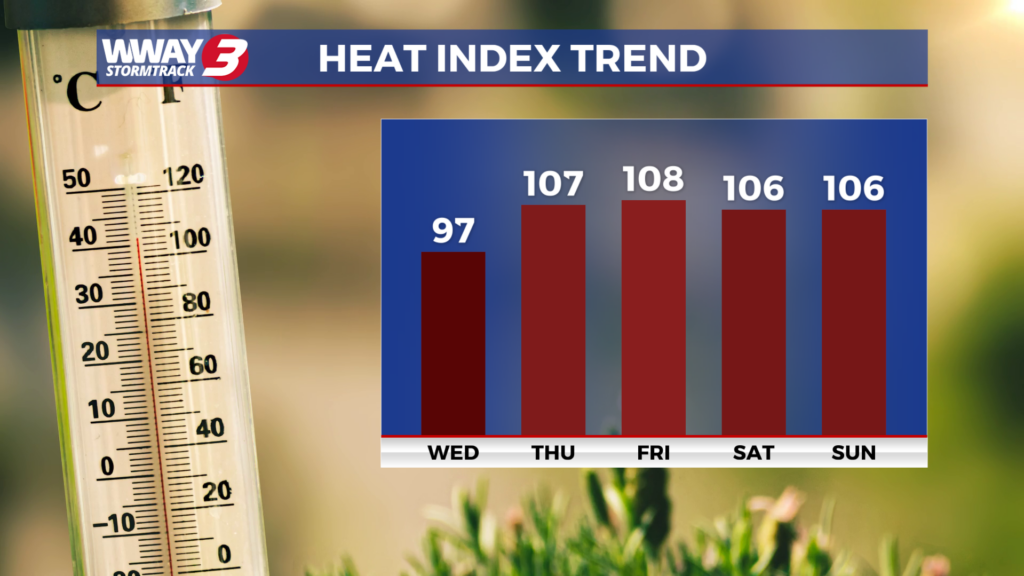
Temperatures return into the upper 90s back for the end of the week.
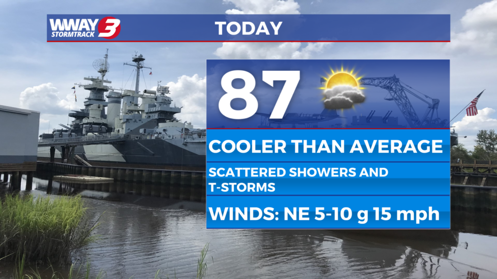
After a rainy couple of days, rain chances will decrease as temperatures increase towards the end of the week.
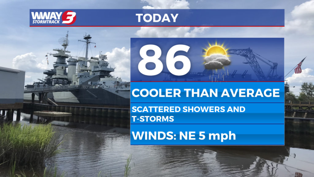
Rain chances return this afternoon with temperatures below average.

Beachgoers are urged to stay out of the ocean after the National Weather Service forecast Red Flag conditions for Oak Island's Beach Warning Flag system on Friday, July 10, 2026.
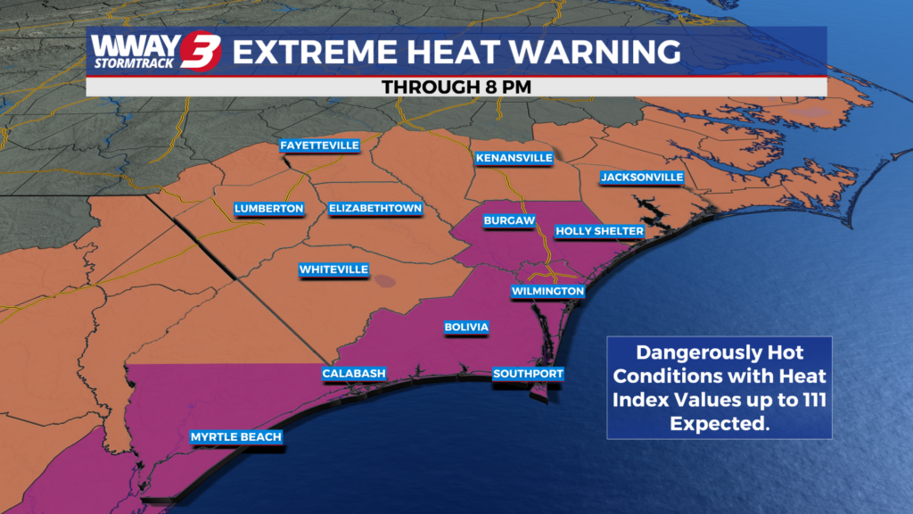
Temperatures could top out in the triple digits once again this afternoon, but rain chances this weekend could cool us off.

Drought conditions have intensified across southeastern North Carolina, with portions of Brunswick and Columbus counties now classified under Exceptional Drought (D4) — the highest level on the U.S. Drought Monitor.
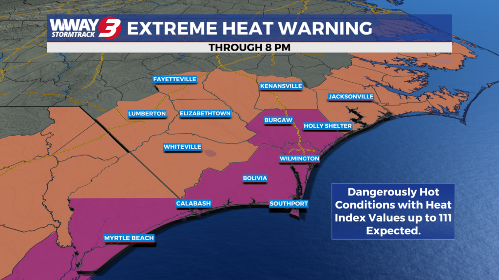
Triple digit arrived in the Cape Fear yesterday and more heat is expected for today.
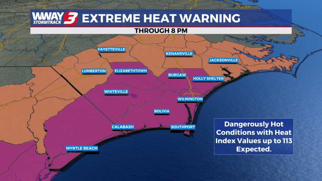
An Extreme Heat Warning is in place for this afternoon with hot and humid conditions once again for today.
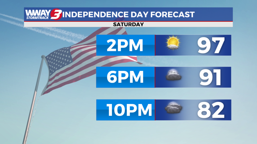
The holiday weekend is here and the heat arrives with it.
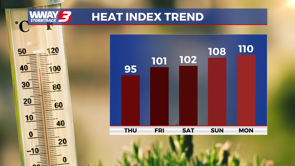
Temperatures will be right near the average for today as temperatures increase for the upcoming holiday weekend.